
TOV Thousand Oaks, California, USA - Earthquake Result Viewer
| ||||||||||||||||||
| ||||||||||||||||||
| ||||||||||||||||||
|
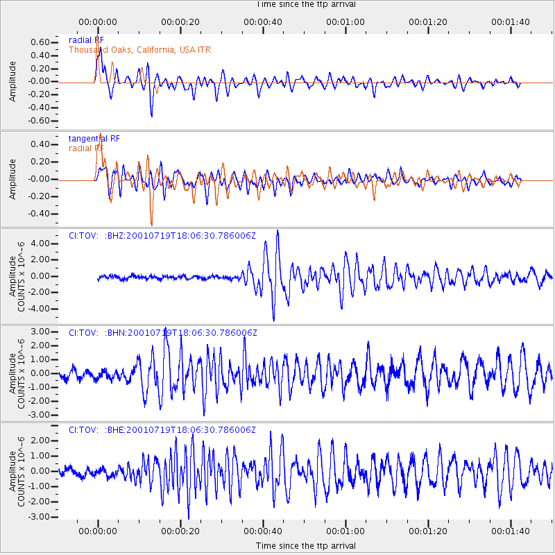
Signal To Noise
| Channel | StoN | STA | LTA |
| CI:TOV: :BHN:20010719T18:06:30.786006Z | 1.1989639 | 3.224251E-7 | 2.689198E-7 |
| CI:TOV: :BHE:20010719T18:06:30.786006Z | 1.0513065 | 2.5297925E-7 | 2.406332E-7 |
| CI:TOV: :BHZ:20010719T18:06:30.786006Z | 0.85519594 | 1.520047E-7 | 1.7774255E-7 |
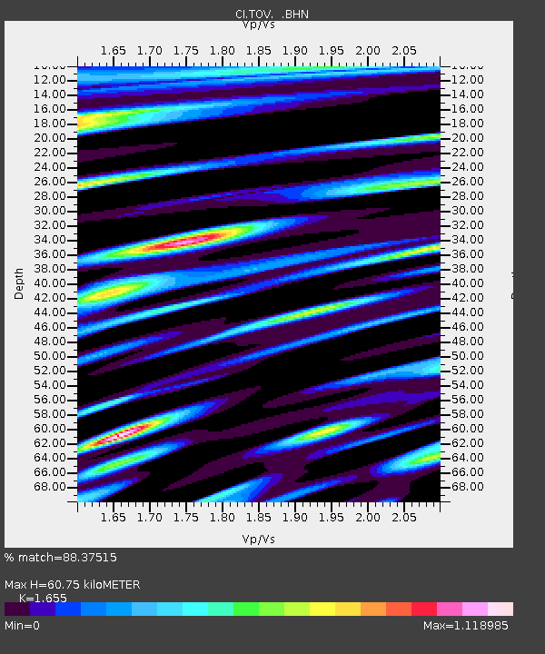
| Arrivals | |
| Ps | 7.0 SECOND |
| PpPs | 24 SECOND |
| PsPs/PpSs | 32 SECOND |

