You are here: Home > Network List > US - United States National Seismic Network Stations List
> Station EGMT Eagleton, Montana, USA > Earthquake Result Viewer
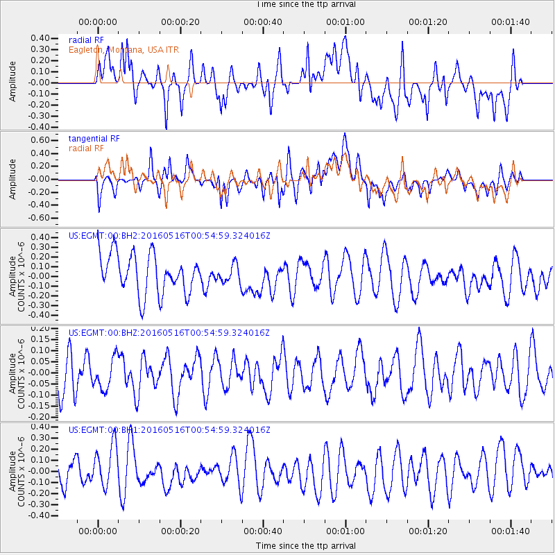
EGMT Eagleton, Montana, USA - Earthquake Result Viewer
*The percent match for this event was below the threshold and hence no stack was calculated.
| Earthquake location: |
Southeast Of Loyalty Islands |
| Earthquake latitude/longitude: |
-22.5/173.0 |
| Earthquake time(UTC): |
2016/05/16 (137) 00:41:53 GMT |
| Earthquake Depth: |
10 km |
| Earthquake Magnitude: |
5.8 MWW, 5.7 MWB, 5.8 MWC |
| Earthquake Catalog/Contributor: |
NEIC PDE/NEIC COMCAT |
|
| Network: |
US United States National Seismic Network |
| Station: |
EGMT Eagleton, Montana, USA |
| Lat/Lon: |
48.02 N/109.75 W |
| Elevation: |
1055 m |
|
| Distance: |
98.4 deg |
| Az: |
41.436 deg |
| Baz: |
245.723 deg |
| Ray Param: |
$rayparam |
*The percent match for this event was below the threshold and hence was not used in the summary stack. |
|
| Radial Match: |
41.059032 % |
| Radial Bump: |
400 |
| Transverse Match: |
51.868603 % |
| Transverse Bump: |
400 |
| SOD ConfigId: |
1475611 |
| Insert Time: |
2016-05-30 00:45:01.776 +0000 |
| GWidth: |
2.5 |
| Max Bumps: |
400 |
| Tol: |
0.001 |
|
Signal To Noise
| Channel | StoN | STA | LTA |
| US:EGMT:00:BHZ:20160516T00:54:59.324016Z | 0.9150791 | 7.058756E-8 | 7.713821E-8 |
| US:EGMT:00:BH1:20160516T00:54:59.324016Z | 1.735538 | 2.153865E-7 | 1.241036E-7 |
| US:EGMT:00:BH2:20160516T00:54:59.324016Z | 0.4720117 | 9.498017E-8 | 2.012242E-7 |
| Arrivals |
| Ps | |
| PpPs | |
| PsPs/PpSs | |


