You are here: Home > Network List > TA - USArray Transportable Network (new EarthScope stations) Stations List
> Station M23A Laramie, WY, USA > Earthquake Result Viewer
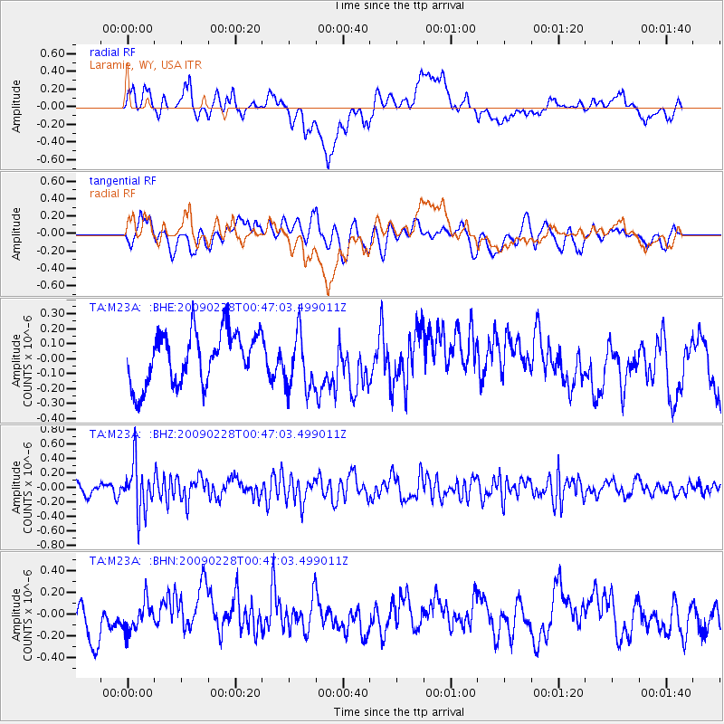
M23A Laramie, WY, USA - Earthquake Result Viewer
*The percent match for this event was below the threshold and hence no stack was calculated.
| Earthquake location: |
Hokkaido, Japan Region |
| Earthquake latitude/longitude: |
42.6/142.1 |
| Earthquake time(UTC): |
2009/02/28 (059) 00:35:56 GMT |
| Earthquake Depth: |
105 km |
| Earthquake Magnitude: |
5.5 MB, 5.5 MW, 5.5 MW |
| Earthquake Catalog/Contributor: |
WHDF/NEIC |
|
| Network: |
TA USArray Transportable Network (new EarthScope stations) |
| Station: |
M23A Laramie, WY, USA |
| Lat/Lon: |
41.47 N/105.72 W |
| Elevation: |
2166 m |
|
| Distance: |
76.4 deg |
| Az: |
45.734 deg |
| Baz: |
315.296 deg |
| Ray Param: |
$rayparam |
*The percent match for this event was below the threshold and hence was not used in the summary stack. |
|
| Radial Match: |
50.681183 % |
| Radial Bump: |
400 |
| Transverse Match: |
51.716698 % |
| Transverse Bump: |
400 |
| SOD ConfigId: |
2658 |
| Insert Time: |
2010-03-06 10:55:31.119 +0000 |
| GWidth: |
2.5 |
| Max Bumps: |
400 |
| Tol: |
0.001 |
|
Signal To Noise
| Channel | StoN | STA | LTA |
| TA:M23A: :BHZ:20090228T00:47:03.499011Z | 2.5868995 | 3.2440283E-7 | 1.2540218E-7 |
| TA:M23A: :BHN:20090228T00:47:03.499011Z | 0.8492249 | 1.3388258E-7 | 1.5765266E-7 |
| TA:M23A: :BHE:20090228T00:47:03.499011Z | 1.1160253 | 1.9246482E-7 | 1.724556E-7 |
| Arrivals |
| Ps | |
| PpPs | |
| PsPs/PpSs | |


