You are here: Home > Network List > TA - USArray Transportable Network (new EarthScope stations) Stations List
> Station M23A Laramie, WY, USA > Earthquake Result Viewer
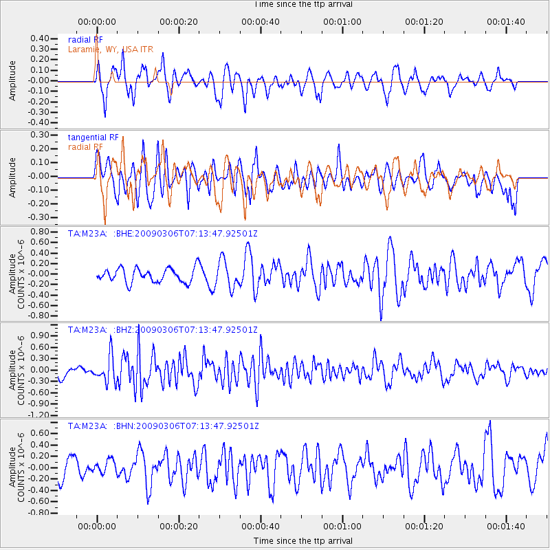
M23A Laramie, WY, USA - Earthquake Result Viewer
*The percent match for this event was below the threshold and hence no stack was calculated.
| Earthquake location: |
Tonga Islands |
| Earthquake latitude/longitude: |
-15.2/-173.3 |
| Earthquake time(UTC): |
2009/03/06 (065) 07:01:48 GMT |
| Earthquake Depth: |
3.0 km |
| Earthquake Magnitude: |
5.5 MB, 5.4 MS, 5.8 MW, 5.8 MW |
| Earthquake Catalog/Contributor: |
WHDF/NEIC |
|
| Network: |
TA USArray Transportable Network (new EarthScope stations) |
| Station: |
M23A Laramie, WY, USA |
| Lat/Lon: |
41.47 N/105.72 W |
| Elevation: |
2166 m |
|
| Distance: |
84.0 deg |
| Az: |
44.318 deg |
| Baz: |
243.858 deg |
| Ray Param: |
$rayparam |
*The percent match for this event was below the threshold and hence was not used in the summary stack. |
|
| Radial Match: |
64.47033 % |
| Radial Bump: |
400 |
| Transverse Match: |
44.20829 % |
| Transverse Bump: |
400 |
| SOD ConfigId: |
2658 |
| Insert Time: |
2010-03-06 10:55:34.968 +0000 |
| GWidth: |
2.5 |
| Max Bumps: |
400 |
| Tol: |
0.001 |
|
Signal To Noise
| Channel | StoN | STA | LTA |
| TA:M23A: :BHZ:20090306T07:13:47.92501Z | 1.8279194 | 3.562605E-7 | 1.9489946E-7 |
| TA:M23A: :BHN:20090306T07:13:47.92501Z | 0.7756636 | 1.1651394E-7 | 1.5021193E-7 |
| TA:M23A: :BHE:20090306T07:13:47.92501Z | 1.9813468 | 2.6339583E-7 | 1.3293777E-7 |
| Arrivals |
| Ps | |
| PpPs | |
| PsPs/PpSs | |


