You are here: Home > Network List > TA - USArray Transportable Network (new EarthScope stations) Stations List
> Station M23A Laramie, WY, USA > Earthquake Result Viewer
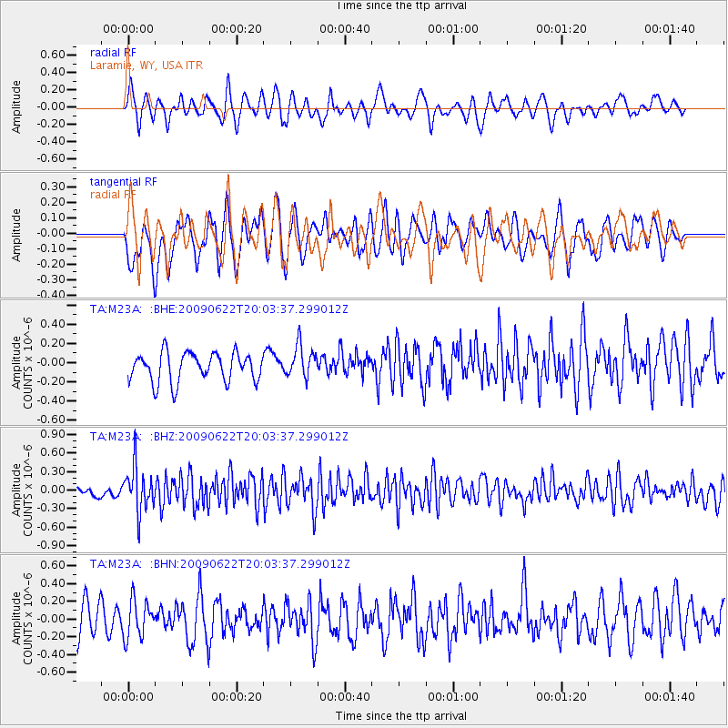
M23A Laramie, WY, USA - Earthquake Result Viewer
*The percent match for this event was below the threshold and hence no stack was calculated.
| Earthquake location: |
Andreanof Islands, Aleutian Is. |
| Earthquake latitude/longitude: |
51.3/-178.2 |
| Earthquake time(UTC): |
2009/06/22 (173) 19:55:24 GMT |
| Earthquake Depth: |
35 km |
| Earthquake Magnitude: |
5.6 MB, 5.6 MW, 5.6 MW |
| Earthquake Catalog/Contributor: |
WHDF/NEIC |
|
| Network: |
TA USArray Transportable Network (new EarthScope stations) |
| Station: |
M23A Laramie, WY, USA |
| Lat/Lon: |
41.47 N/105.72 W |
| Elevation: |
2166 m |
|
| Distance: |
49.0 deg |
| Az: |
71.606 deg |
| Baz: |
307.526 deg |
| Ray Param: |
$rayparam |
*The percent match for this event was below the threshold and hence was not used in the summary stack. |
|
| Radial Match: |
57.672184 % |
| Radial Bump: |
400 |
| Transverse Match: |
56.86412 % |
| Transverse Bump: |
400 |
| SOD ConfigId: |
2648 |
| Insert Time: |
2010-03-06 10:55:47.722 +0000 |
| GWidth: |
2.5 |
| Max Bumps: |
400 |
| Tol: |
0.001 |
|
Signal To Noise
| Channel | StoN | STA | LTA |
| TA:M23A: :BHZ:20090622T20:03:37.299012Z | 4.1073027 | 3.620688E-7 | 8.815245E-8 |
| TA:M23A: :BHN:20090622T20:03:37.299012Z | 0.94254065 | 2.1189473E-7 | 2.248123E-7 |
| TA:M23A: :BHE:20090622T20:03:37.299012Z | 1.1286709 | 1.7005736E-7 | 1.5067046E-7 |
| Arrivals |
| Ps | |
| PpPs | |
| PsPs/PpSs | |


