You are here: Home > Network List > TA - USArray Transportable Network (new EarthScope stations) Stations List
> Station P17K Kvichak River, AK, USA > Earthquake Result Viewer
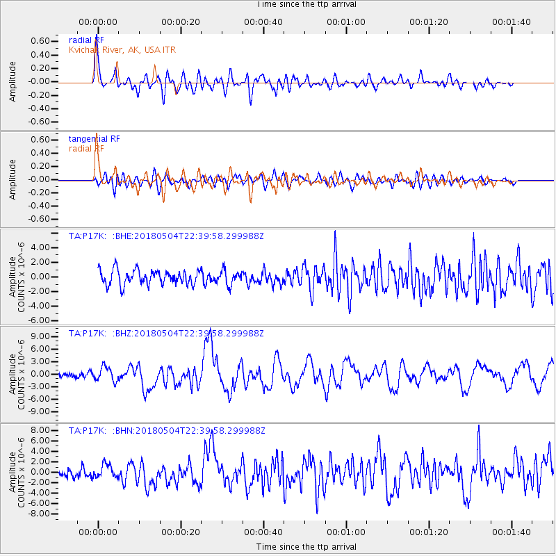
P17K Kvichak River, AK, USA - Earthquake Result Viewer
*The percent match for this event was below the threshold and hence no stack was calculated.
| Earthquake location: |
Hawaii |
| Earthquake latitude/longitude: |
19.4/-155.0 |
| Earthquake time(UTC): |
2018/05/04 (124) 22:32:55 GMT |
| Earthquake Depth: |
5.0 km |
| Earthquake Magnitude: |
5.8 Ml |
| Earthquake Catalog/Contributor: |
NEIC PDE/us |
|
| Network: |
TA USArray Transportable Network (new EarthScope stations) |
| Station: |
P17K Kvichak River, AK, USA |
| Lat/Lon: |
59.20 N/156.44 W |
| Elevation: |
91 m |
|
| Distance: |
39.8 deg |
| Az: |
358.868 deg |
| Baz: |
177.924 deg |
| Ray Param: |
$rayparam |
*The percent match for this event was below the threshold and hence was not used in the summary stack. |
|
| Radial Match: |
78.12952 % |
| Radial Bump: |
400 |
| Transverse Match: |
57.24344 % |
| Transverse Bump: |
400 |
| SOD ConfigId: |
13570011 |
| Insert Time: |
2019-04-30 05:05:04.965 +0000 |
| GWidth: |
2.5 |
| Max Bumps: |
400 |
| Tol: |
0.001 |
|
Signal To Noise
| Channel | StoN | STA | LTA |
| TA:P17K: :BHZ:20180504T22:39:58.299988Z | 3.6370358 | 1.7406765E-6 | 4.785976E-7 |
| TA:P17K: :BHN:20180504T22:39:58.299988Z | 1.6181664 | 1.3249928E-6 | 8.1882354E-7 |
| TA:P17K: :BHE:20180504T22:39:58.299988Z | 1.0215319 | 9.987197E-7 | 9.776686E-7 |
| Arrivals |
| Ps | |
| PpPs | |
| PsPs/PpSs | |


