You are here: Home > Network List > TA - USArray Transportable Network (new EarthScope stations) Stations List
> Station M23A Laramie, WY, USA > Earthquake Result Viewer
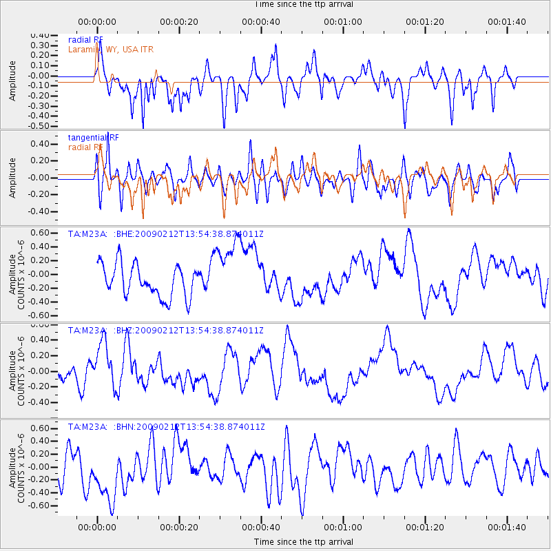
M23A Laramie, WY, USA - Earthquake Result Viewer
*The percent match for this event was below the threshold and hence no stack was calculated.
| Earthquake location: |
South Of Mariana Islands |
| Earthquake latitude/longitude: |
12.1/143.8 |
| Earthquake time(UTC): |
2009/02/12 (043) 13:41:43 GMT |
| Earthquake Depth: |
40 km |
| Earthquake Magnitude: |
5.5 MB |
| Earthquake Catalog/Contributor: |
WHDF/NEIC |
|
| Network: |
TA USArray Transportable Network (new EarthScope stations) |
| Station: |
M23A Laramie, WY, USA |
| Lat/Lon: |
41.47 N/105.72 W |
| Elevation: |
2166 m |
|
| Distance: |
96.9 deg |
| Az: |
45.151 deg |
| Baz: |
292.703 deg |
| Ray Param: |
$rayparam |
*The percent match for this event was below the threshold and hence was not used in the summary stack. |
|
| Radial Match: |
50.63134 % |
| Radial Bump: |
400 |
| Transverse Match: |
53.05881 % |
| Transverse Bump: |
400 |
| SOD ConfigId: |
2658 |
| Insert Time: |
2010-03-06 10:56:21.679 +0000 |
| GWidth: |
2.5 |
| Max Bumps: |
400 |
| Tol: |
0.001 |
|
Signal To Noise
| Channel | StoN | STA | LTA |
| TA:M23A: :BHZ:20090212T13:54:38.874011Z | 3.1049936 | 2.994497E-7 | 9.644133E-8 |
| TA:M23A: :BHN:20090212T13:54:38.874011Z | 1.6956952 | 4.85391E-7 | 2.86249E-7 |
| TA:M23A: :BHE:20090212T13:54:38.874011Z | 2.0658207 | 4.7546018E-7 | 2.3015559E-7 |
| Arrivals |
| Ps | |
| PpPs | |
| PsPs/PpSs | |


