
K22A Casper, WY, USA - Earthquake Result Viewer
| ||||||||||||||||||
| ||||||||||||||||||
| ||||||||||||||||||
|
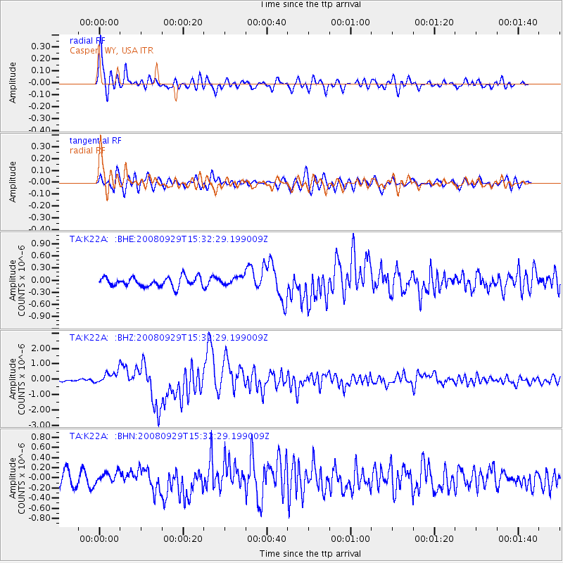
Signal To Noise
| Channel | StoN | STA | LTA |
| TA:K22A: :BHZ:20080929T15:32:29.199009Z | 5.573854 | 4.238572E-7 | 7.6043825E-8 |
| TA:K22A: :BHN:20080929T15:32:29.199009Z | 0.7162515 | 1.0146977E-7 | 1.416678E-7 |
| TA:K22A: :BHE:20080929T15:32:29.199009Z | 0.9106793 | 1.06830456E-7 | 1.1730854E-7 |
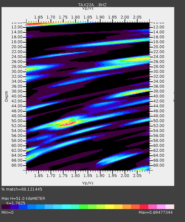
| Arrivals | |
| Ps | 6.4 SECOND |
| PpPs | 22 SECOND |
| PsPs/PpSs | 29 SECOND |

