You are here: Home > Network List > TA - USArray Transportable Network (new EarthScope stations) Stations List
> Station K22A Casper, WY, USA > Earthquake Result Viewer
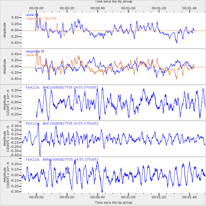
K22A Casper, WY, USA - Earthquake Result Viewer
*The percent match for this event was below the threshold and hence no stack was calculated.
| Earthquake location: |
Kuril Islands |
| Earthquake latitude/longitude: |
46.7/152.5 |
| Earthquake time(UTC): |
2008/08/27 (240) 05:24:41 GMT |
| Earthquake Depth: |
65 km |
| Earthquake Magnitude: |
5.5 MB, 5.4 MW, 5.3 MW |
| Earthquake Catalog/Contributor: |
WHDF/NEIC |
|
| Network: |
TA USArray Transportable Network (new EarthScope stations) |
| Station: |
K22A Casper, WY, USA |
| Lat/Lon: |
42.65 N/106.52 W |
| Elevation: |
1686 m |
|
| Distance: |
66.8 deg |
| Az: |
51.967 deg |
| Baz: |
312.738 deg |
| Ray Param: |
$rayparam |
*The percent match for this event was below the threshold and hence was not used in the summary stack. |
|
| Radial Match: |
58.730892 % |
| Radial Bump: |
400 |
| Transverse Match: |
61.80584 % |
| Transverse Bump: |
400 |
| SOD ConfigId: |
2504 |
| Insert Time: |
2010-03-06 10:58:24.798 +0000 |
| GWidth: |
2.5 |
| Max Bumps: |
400 |
| Tol: |
0.001 |
|
Signal To Noise
| Channel | StoN | STA | LTA |
| TA:K22A: :BHZ:20080827T05:34:55.375005Z | 3.9055521 | 1.8821247E-7 | 4.8191E-8 |
| TA:K22A: :BHN:20080827T05:34:55.375005Z | 0.7684905 | 5.9459758E-8 | 7.737215E-8 |
| TA:K22A: :BHE:20080827T05:34:55.375005Z | 0.9359194 | 1.0018724E-7 | 1.0704687E-7 |
| Arrivals |
| Ps | |
| PpPs | |
| PsPs/PpSs | |


