You are here: Home > Network List > TA - USArray Transportable Network (new EarthScope stations) Stations List
> Station J26L Joseph Creek, AK, USA > Earthquake Result Viewer
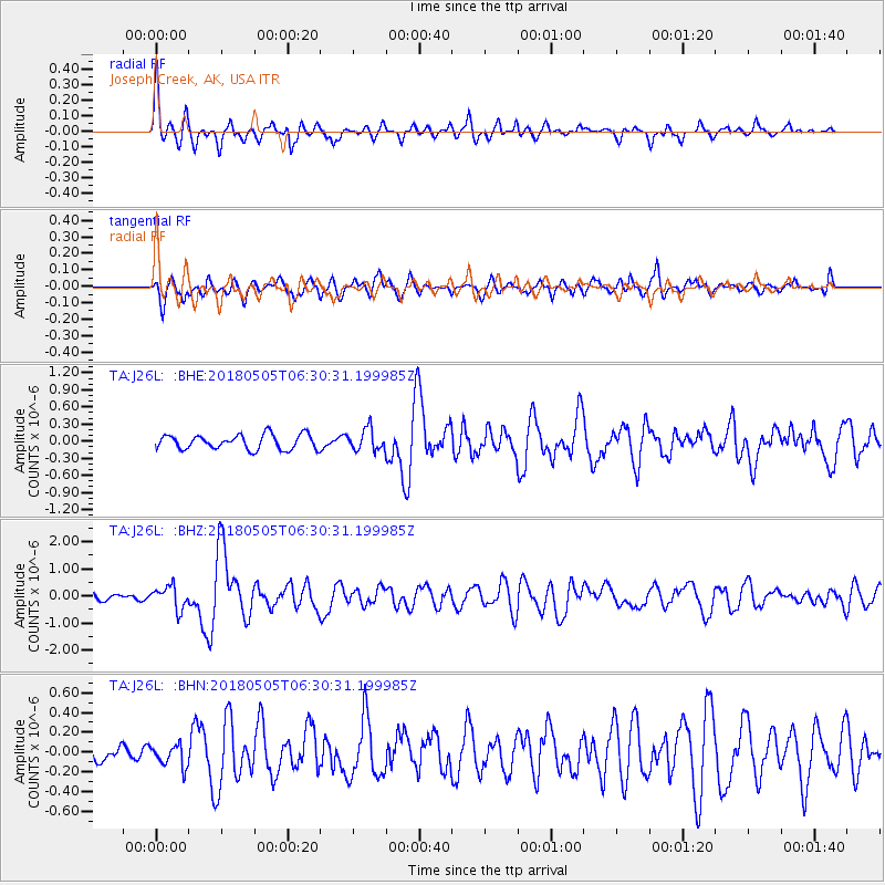
J26L Joseph Creek, AK, USA - Earthquake Result Viewer
*The percent match for this event was below the threshold and hence no stack was calculated.
| Earthquake location: |
Luzon, Philippines |
| Earthquake latitude/longitude: |
14.5/123.9 |
| Earthquake time(UTC): |
2018/05/05 (125) 06:19:04 GMT |
| Earthquake Depth: |
18 km |
| Earthquake Magnitude: |
6.1 Mww |
| Earthquake Catalog/Contributor: |
NEIC PDE/us |
|
| Network: |
TA USArray Transportable Network (new EarthScope stations) |
| Station: |
J26L Joseph Creek, AK, USA |
| Lat/Lon: |
64.50 N/143.56 W |
| Elevation: |
1144 m |
|
| Distance: |
78.1 deg |
| Az: |
26.226 deg |
| Baz: |
278.571 deg |
| Ray Param: |
$rayparam |
*The percent match for this event was below the threshold and hence was not used in the summary stack. |
|
| Radial Match: |
71.870316 % |
| Radial Bump: |
400 |
| Transverse Match: |
65.47709 % |
| Transverse Bump: |
400 |
| SOD ConfigId: |
13570011 |
| Insert Time: |
2019-04-30 05:13:46.939 +0000 |
| GWidth: |
2.5 |
| Max Bumps: |
400 |
| Tol: |
0.001 |
|
Signal To Noise
| Channel | StoN | STA | LTA |
| TA:J26L: :BHZ:20180505T06:30:31.199985Z | 3.0435758 | 4.1654823E-7 | 1.3686146E-7 |
| TA:J26L: :BHN:20180505T06:30:31.199985Z | 1.1945472 | 1.0859231E-7 | 9.0906674E-8 |
| TA:J26L: :BHE:20180505T06:30:31.199985Z | 1.4696732 | 1.8799635E-7 | 1.2791712E-7 |
| Arrivals |
| Ps | |
| PpPs | |
| PsPs/PpSs | |


