You are here: Home > Network List > CI - Caltech Regional Seismic Network Stations List
> Station BFS Mt Baldy Forest Station > Earthquake Result Viewer
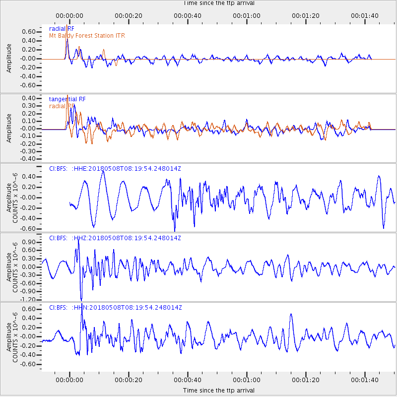
BFS Mt Baldy Forest Station - Earthquake Result Viewer
*The percent match for this event was below the threshold and hence no stack was calculated.
| Earthquake location: |
Gulf Of Alaska |
| Earthquake latitude/longitude: |
56.4/-148.5 |
| Earthquake time(UTC): |
2018/05/08 (128) 08:14:12 GMT |
| Earthquake Depth: |
10 km |
| Earthquake Magnitude: |
5.5 Mww |
| Earthquake Catalog/Contributor: |
NEIC PDE/us |
|
| Network: |
CI Caltech Regional Seismic Network |
| Station: |
BFS Mt Baldy Forest Station |
| Lat/Lon: |
34.24 N/117.66 W |
| Elevation: |
1312 m |
|
| Distance: |
30.5 deg |
| Az: |
123.38 deg |
| Baz: |
325.876 deg |
| Ray Param: |
$rayparam |
*The percent match for this event was below the threshold and hence was not used in the summary stack. |
|
| Radial Match: |
70.83094 % |
| Radial Bump: |
400 |
| Transverse Match: |
55.50536 % |
| Transverse Bump: |
308 |
| SOD ConfigId: |
13570011 |
| Insert Time: |
2019-04-30 05:28:59.093 +0000 |
| GWidth: |
2.5 |
| Max Bumps: |
400 |
| Tol: |
0.001 |
|
Signal To Noise
| Channel | StoN | STA | LTA |
| CI:BFS: :HHZ:20180508T08:19:54.248014Z | 2.9358597 | 5.113383E-7 | 1.7416988E-7 |
| CI:BFS: :HHN:20180508T08:19:54.248014Z | 2.5741282 | 2.7111585E-7 | 1.0532337E-7 |
| CI:BFS: :HHE:20180508T08:19:54.248014Z | 1.075733 | 2.8076485E-7 | 2.6099863E-7 |
| Arrivals |
| Ps | |
| PpPs | |
| PsPs/PpSs | |


