You are here: Home > Network List > TA - USArray Transportable Network (new EarthScope stations) Stations List
> Station K22A Casper, WY, USA > Earthquake Result Viewer
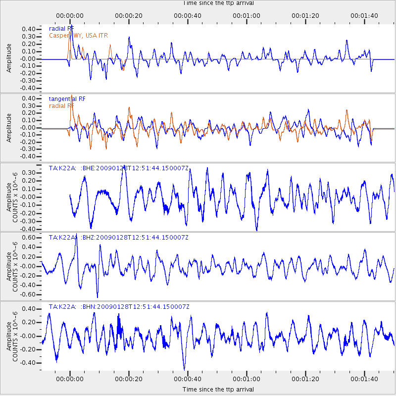
K22A Casper, WY, USA - Earthquake Result Viewer
*The percent match for this event was below the threshold and hence no stack was calculated.
| Earthquake location: |
Samoa Islands Region |
| Earthquake latitude/longitude: |
-17.0/-172.1 |
| Earthquake time(UTC): |
2009/01/28 (028) 12:39:42 GMT |
| Earthquake Depth: |
10 km |
| Earthquake Magnitude: |
5.6 MB, 5.3 MS, 5.5 MW |
| Earthquake Catalog/Contributor: |
WHDF/NEIC |
|
| Network: |
TA USArray Transportable Network (new EarthScope stations) |
| Station: |
K22A Casper, WY, USA |
| Lat/Lon: |
42.65 N/106.52 W |
| Elevation: |
1686 m |
|
| Distance: |
84.5 deg |
| Az: |
42.432 deg |
| Baz: |
241.069 deg |
| Ray Param: |
$rayparam |
*The percent match for this event was below the threshold and hence was not used in the summary stack. |
|
| Radial Match: |
59.700466 % |
| Radial Bump: |
400 |
| Transverse Match: |
55.431374 % |
| Transverse Bump: |
400 |
| SOD ConfigId: |
2658 |
| Insert Time: |
2010-03-06 10:59:45.158 +0000 |
| GWidth: |
2.5 |
| Max Bumps: |
400 |
| Tol: |
0.001 |
|
Signal To Noise
| Channel | StoN | STA | LTA |
| TA:K22A: :BHZ:20090128T12:51:44.150007Z | 2.1660209 | 3.0880588E-7 | 1.425683E-7 |
| TA:K22A: :BHN:20090128T12:51:44.150007Z | 0.7778538 | 1.2691879E-7 | 1.6316535E-7 |
| TA:K22A: :BHE:20090128T12:51:44.150007Z | 0.7447674 | 1.236426E-7 | 1.6601506E-7 |
| Arrivals |
| Ps | |
| PpPs | |
| PsPs/PpSs | |


