You are here: Home > Network List > TA - USArray Transportable Network (new EarthScope stations) Stations List
> Station 121A Cookes Peak, Deming, NM, USA > Earthquake Result Viewer
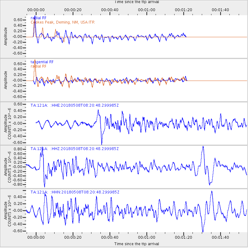
121A Cookes Peak, Deming, NM, USA - Earthquake Result Viewer
*The percent match for this event was below the threshold and hence no stack was calculated.
| Earthquake location: |
Gulf Of Alaska |
| Earthquake latitude/longitude: |
56.4/-148.5 |
| Earthquake time(UTC): |
2018/05/08 (128) 08:14:12 GMT |
| Earthquake Depth: |
10 km |
| Earthquake Magnitude: |
5.5 Mww |
| Earthquake Catalog/Contributor: |
NEIC PDE/us |
|
| Network: |
TA USArray Transportable Network (new EarthScope stations) |
| Station: |
121A Cookes Peak, Deming, NM, USA |
| Lat/Lon: |
32.53 N/107.79 W |
| Elevation: |
1652 m |
|
| Distance: |
36.8 deg |
| Az: |
113.062 deg |
| Baz: |
322.684 deg |
| Ray Param: |
$rayparam |
*The percent match for this event was below the threshold and hence was not used in the summary stack. |
|
| Radial Match: |
74.94589 % |
| Radial Bump: |
400 |
| Transverse Match: |
57.5586 % |
| Transverse Bump: |
400 |
| SOD ConfigId: |
13570011 |
| Insert Time: |
2019-04-30 05:34:07.832 +0000 |
| GWidth: |
2.5 |
| Max Bumps: |
400 |
| Tol: |
0.001 |
|
Signal To Noise
| Channel | StoN | STA | LTA |
| TA:121A: :HHZ:20180508T08:20:48.299985Z | 4.345987 | 4.5535202E-7 | 1.0477529E-7 |
| TA:121A: :HHN:20180508T08:20:48.299985Z | 2.54825 | 2.1475188E-7 | 8.427426E-8 |
| TA:121A: :HHE:20180508T08:20:48.299985Z | 3.438237 | 2.3448891E-7 | 6.8200336E-8 |
| Arrivals |
| Ps | |
| PpPs | |
| PsPs/PpSs | |


