You are here: Home > Network List > TA - USArray Transportable Network (new EarthScope stations) Stations List
> Station MDND Maddock, ND, USA > Earthquake Result Viewer
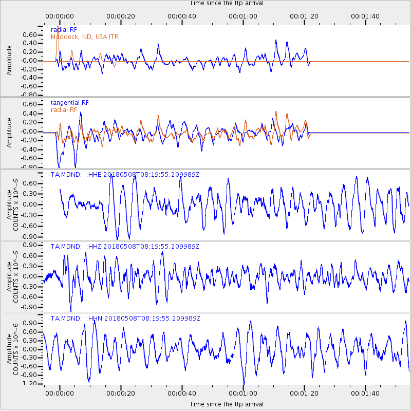
MDND Maddock, ND, USA - Earthquake Result Viewer
*The percent match for this event was below the threshold and hence no stack was calculated.
| Earthquake location: |
Gulf Of Alaska |
| Earthquake latitude/longitude: |
56.4/-148.5 |
| Earthquake time(UTC): |
2018/05/08 (128) 08:14:12 GMT |
| Earthquake Depth: |
10 km |
| Earthquake Magnitude: |
5.5 Mww |
| Earthquake Catalog/Contributor: |
NEIC PDE/us |
|
| Network: |
TA USArray Transportable Network (new EarthScope stations) |
| Station: |
MDND Maddock, ND, USA |
| Lat/Lon: |
47.85 N/99.60 W |
| Elevation: |
479 m |
|
| Distance: |
30.6 deg |
| Az: |
85.136 deg |
| Baz: |
304.583 deg |
| Ray Param: |
$rayparam |
*The percent match for this event was below the threshold and hence was not used in the summary stack. |
|
| Radial Match: |
50.11613 % |
| Radial Bump: |
400 |
| Transverse Match: |
60.565727 % |
| Transverse Bump: |
349 |
| SOD ConfigId: |
13570011 |
| Insert Time: |
2019-04-30 05:34:13.854 +0000 |
| GWidth: |
2.5 |
| Max Bumps: |
400 |
| Tol: |
0.001 |
|
Signal To Noise
| Channel | StoN | STA | LTA |
| TA:MDND: :HHZ:20180508T08:19:55.209989Z | 2.97449 | 3.994797E-7 | 1.3430191E-7 |
| TA:MDND: :HHN:20180508T08:19:55.209989Z | 0.7144784 | 3.3231146E-7 | 4.6511062E-7 |
| TA:MDND: :HHE:20180508T08:19:55.209989Z | 0.4657016 | 1.871063E-7 | 4.0177295E-7 |
| Arrivals |
| Ps | |
| PpPs | |
| PsPs/PpSs | |


