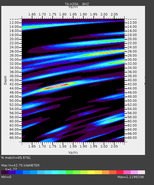
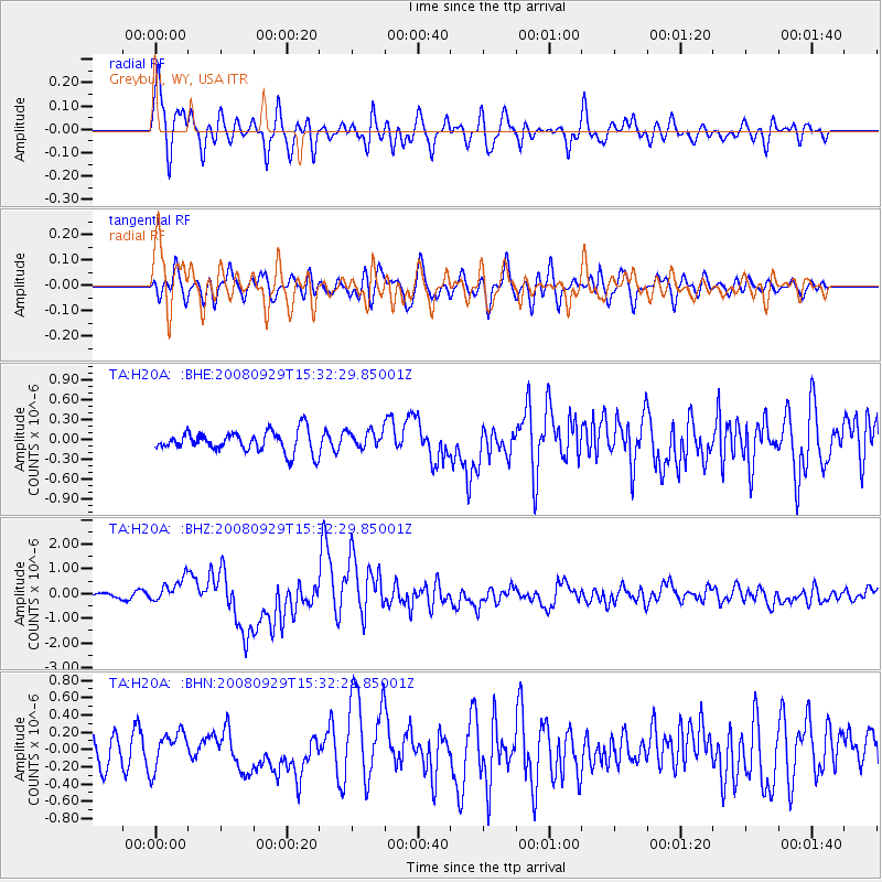
H20A Greybull, WY, USA - Earthquake Result Viewer

Earthquake location: Kermadec Islands, New Zealand
Earthquake latitude/longitude: -29.8/-177.7
Earthquake time(UTC): 2008/09/29 (273) 15:19:31 GMT
Earthquake Depth: 36 km
Earthquake Magnitude: 6.5 MB, 6.7 MS, 7.0 MW, 7.0 MW
Earthquake Catalog/Contributor: WHDF/NEIC
Network: TA USArray Transportable Network (new EarthScope stations)
Station: H20A Greybull, WY, USA
Lat/Lon: 44.49 N/108.00 W
Elevation: 1236 m
Distance: 97.4 deg
Az: 42.599 deg
Baz: 235.318 deg
Ray Param: 0.040208045
Estimated Moho Depth: 42.75 km
Estimated Crust Vp/Vs: 1.77
Assumed Crust Vp: 6.178 km/s
Estimated Crust Vs: 3.491 km/s
Estimated Crust Poisson's Ratio: 0.27
Radial Match: 85.9761 %
Radial Bump: 400
Transverse Match: 68.30263 %
Transverse Bump: 400
SOD ConfigId: 2560
Insert Time: 2010-03-06 11:04:07.011 +0000
GWidth: 2.5
Max Bumps: 400
Tol: 0.001

Signal To Noise

ChannelStoNSTALTA
TA:H20A: :BHZ:20080929T15:32:29.85001Z5.2998514.761964E-78.985091E-8
TA:H20A: :BHN:20080929T15:32:29.85001Z1.81617782.1381433E-71.1772764E-7
TA:H20A: :BHE:20080929T15:32:29.85001Z0.82508331.2826786E-71.5546048E-7
Arrivals
Ps5.4 SECOND
PpPs19 SECOND
PsPs/PpSs24 SECOND