You are here: Home > Network List > TA - USArray Transportable Network (new EarthScope stations) Stations List
> Station H20A Greybull, WY, USA > Earthquake Result Viewer
H20A Greybull, WY, USA - Earthquake Result Viewer
*The percent match for this event was below the threshold and hence no stack was calculated.
| Earthquake location: |
Arctic Ocean |
| Earthquake latitude/longitude: |
79.8/-115.4 |
| Earthquake time(UTC): |
2008/10/07 (281) 10:00:48 GMT |
| Earthquake Depth: |
10 km |
| Earthquake Magnitude: |
5.6 MB, 5.5 MS, 5.7 MW, 5.7 MW |
| Earthquake Catalog/Contributor: |
WHDF/NEIC |
|
| Network: |
TA USArray Transportable Network (new EarthScope stations) |
| Station: |
H20A Greybull, WY, USA |
| Lat/Lon: |
44.49 N/108.00 W |
| Elevation: |
1236 m |
|
| Distance: |
35.6 deg |
| Az: |
170.819 deg |
| Baz: |
357.727 deg |
| Ray Param: |
$rayparam |
*The percent match for this event was below the threshold and hence was not used in the summary stack. |
|
| Radial Match: |
61.182148 % |
| Radial Bump: |
400 |
| Transverse Match: |
63.29775 % |
| Transverse Bump: |
400 |
| SOD ConfigId: |
2556 |
| Insert Time: |
2010-03-06 11:05:43.663 +0000 |
| GWidth: |
2.5 |
| Max Bumps: |
400 |
| Tol: |
0.001 |
|
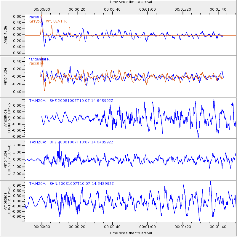
Signal To Noise
| Channel | StoN | STA | LTA |
| TA:H20A: :BHZ:20081007T10:07:14.648992Z | 2.2940743 | 3.8496373E-7 | 1.6780785E-7 |
| TA:H20A: :BHN:20081007T10:07:14.648992Z | 0.8977896 | 2.3623467E-7 | 2.631292E-7 |
| TA:H20A: :BHE:20081007T10:07:14.648992Z | 0.92985666 | 1.2929998E-7 | 1.3905367E-7 |
| Arrivals |
| Ps | |
| PpPs | |
| PsPs/PpSs | |


