You are here: Home > Network List > TA - USArray Transportable Network (new EarthScope stations) Stations List
> Station H20A Greybull, WY, USA > Earthquake Result Viewer
H20A Greybull, WY, USA - Earthquake Result Viewer
*The percent match for this event was below the threshold and hence no stack was calculated.
| Earthquake location: |
Volcano Islands, Japan Region |
| Earthquake latitude/longitude: |
22.6/143.3 |
| Earthquake time(UTC): |
2009/07/29 (210) 14:52:08 GMT |
| Earthquake Depth: |
140 km |
| Earthquake Magnitude: |
5.5 MW, 5.2 MB, 5.4 MW |
| Earthquake Catalog/Contributor: |
WHDF/NEIC |
|
| Network: |
TA USArray Transportable Network (new EarthScope stations) |
| Station: |
H20A Greybull, WY, USA |
| Lat/Lon: |
44.49 N/108.00 W |
| Elevation: |
1236 m |
|
| Distance: |
86.9 deg |
| Az: |
42.751 deg |
| Baz: |
298.766 deg |
| Ray Param: |
$rayparam |
*The percent match for this event was below the threshold and hence was not used in the summary stack. |
|
| Radial Match: |
48.13875 % |
| Radial Bump: |
400 |
| Transverse Match: |
27.551579 % |
| Transverse Bump: |
400 |
| SOD ConfigId: |
2622 |
| Insert Time: |
2010-03-06 11:06:01.591 +0000 |
| GWidth: |
2.5 |
| Max Bumps: |
400 |
| Tol: |
0.001 |
|
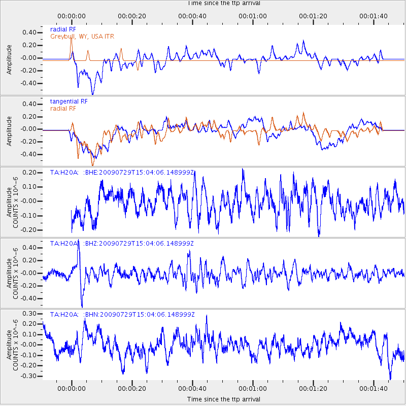
Signal To Noise
| Channel | StoN | STA | LTA |
| TA:H20A: :BHZ:20090729T15:04:06.148999Z | 4.003959 | 2.4900012E-7 | 6.2188484E-8 |
| TA:H20A: :BHN:20090729T15:04:06.148999Z | 0.6255068 | 1.18831444E-7 | 1.8997626E-7 |
| TA:H20A: :BHE:20090729T15:04:06.148999Z | 1.1149846 | 9.2661224E-8 | 8.3105384E-8 |
| Arrivals |
| Ps | |
| PpPs | |
| PsPs/PpSs | |


