You are here: Home > Network List > TA - USArray Transportable Network (new EarthScope stations) Stations List
> Station H20A Greybull, WY, USA > Earthquake Result Viewer
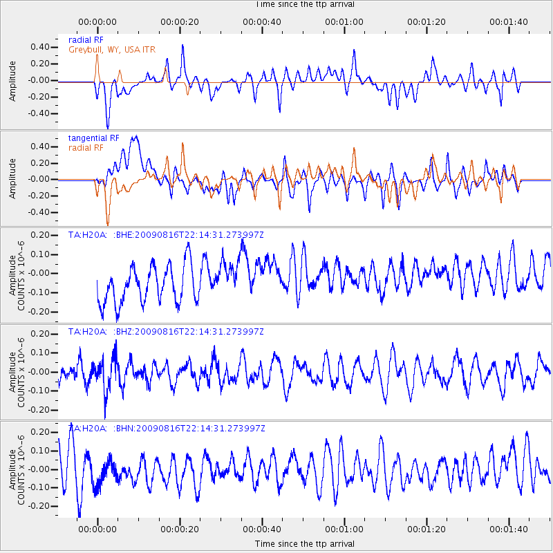
H20A Greybull, WY, USA - Earthquake Result Viewer
*The percent match for this event was below the threshold and hence no stack was calculated.
| Earthquake location: |
Fiji Islands Region |
| Earthquake latitude/longitude: |
-17.9/-179.4 |
| Earthquake time(UTC): |
2009/08/16 (228) 22:03:09 GMT |
| Earthquake Depth: |
626 km |
| Earthquake Magnitude: |
5.5 MW, 4.9 MB |
| Earthquake Catalog/Contributor: |
WHDF/NEIC |
|
| Network: |
TA USArray Transportable Network (new EarthScope stations) |
| Station: |
H20A Greybull, WY, USA |
| Lat/Lon: |
44.49 N/108.00 W |
| Elevation: |
1236 m |
|
| Distance: |
89.8 deg |
| Az: |
42.717 deg |
| Baz: |
244.46 deg |
| Ray Param: |
$rayparam |
*The percent match for this event was below the threshold and hence was not used in the summary stack. |
|
| Radial Match: |
41.983173 % |
| Radial Bump: |
400 |
| Transverse Match: |
45.24666 % |
| Transverse Bump: |
400 |
| SOD ConfigId: |
2622 |
| Insert Time: |
2010-03-06 11:06:09.779 +0000 |
| GWidth: |
2.5 |
| Max Bumps: |
400 |
| Tol: |
0.001 |
|
Signal To Noise
| Channel | StoN | STA | LTA |
| TA:H20A: :BHZ:20090816T22:14:31.273997Z | 2.0235198 | 8.382278E-8 | 4.142425E-8 |
| TA:H20A: :BHN:20090816T22:14:31.273997Z | 0.7664722 | 7.4256874E-8 | 9.6881365E-8 |
| TA:H20A: :BHE:20090816T22:14:31.273997Z | 1.1048084 | 1.0539472E-7 | 9.539637E-8 |
| Arrivals |
| Ps | |
| PpPs | |
| PsPs/PpSs | |


