You are here: Home > Network List > TA - USArray Transportable Network (new EarthScope stations) Stations List
> Station H20A Greybull, WY, USA > Earthquake Result Viewer
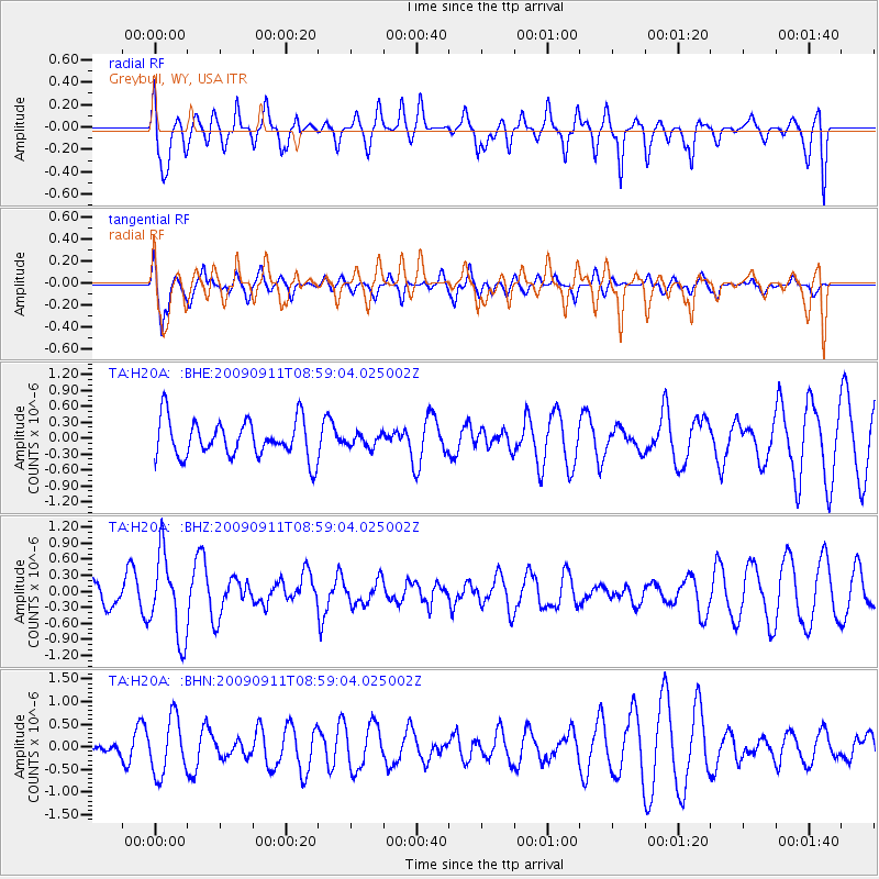
H20A Greybull, WY, USA - Earthquake Result Viewer
*The percent match for this event was below the threshold and hence no stack was calculated.
| Earthquake location: |
Kuril Islands |
| Earthquake latitude/longitude: |
48.3/154.2 |
| Earthquake time(UTC): |
2009/09/11 (254) 08:49:11 GMT |
| Earthquake Depth: |
35 km |
| Earthquake Magnitude: |
5.8 MB, 5.0 MS, 5.6 MW, 5.6 MW |
| Earthquake Catalog/Contributor: |
WHDF/NEIC |
|
| Network: |
TA USArray Transportable Network (new EarthScope stations) |
| Station: |
H20A Greybull, WY, USA |
| Lat/Lon: |
44.49 N/108.00 W |
| Elevation: |
1236 m |
|
| Distance: |
62.9 deg |
| Az: |
52.795 deg |
| Baz: |
312.003 deg |
| Ray Param: |
$rayparam |
*The percent match for this event was below the threshold and hence was not used in the summary stack. |
|
| Radial Match: |
56.194366 % |
| Radial Bump: |
400 |
| Transverse Match: |
68.8813 % |
| Transverse Bump: |
400 |
| SOD ConfigId: |
2622 |
| Insert Time: |
2010-03-06 11:06:23.685 +0000 |
| GWidth: |
2.5 |
| Max Bumps: |
400 |
| Tol: |
0.001 |
|
Signal To Noise
| Channel | StoN | STA | LTA |
| TA:H20A: :BHZ:20090911T08:59:04.025002Z | 2.022392 | 7.693469E-7 | 3.8041435E-7 |
| TA:H20A: :BHN:20090911T08:59:04.025002Z | 2.4359207 | 6.2144017E-7 | 2.5511508E-7 |
| TA:H20A: :BHE:20090911T08:59:04.025002Z | 0.34634033 | 1.2185549E-7 | 3.5183746E-7 |
| Arrivals |
| Ps | |
| PpPs | |
| PsPs/PpSs | |


