You are here: Home > Network List > UW - Pacific Northwest Regional Seismic Network Stations List
> Station UMAT Pilot Rock, OR, USA > Earthquake Result Viewer
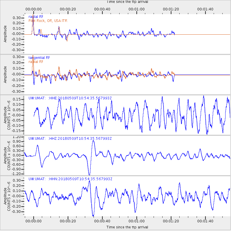
UMAT Pilot Rock, OR, USA - Earthquake Result Viewer
*The percent match for this event was below the threshold and hence no stack was calculated.
| Earthquake location: |
Afghanistan-Tajikistan Bord Reg. |
| Earthquake latitude/longitude: |
37.0/71.4 |
| Earthquake time(UTC): |
2018/05/09 (129) 10:41:45 GMT |
| Earthquake Depth: |
112 km |
| Earthquake Magnitude: |
6.2 Mww |
| Earthquake Catalog/Contributor: |
NEIC PDE/us |
|
| Network: |
UW Pacific Northwest Regional Seismic Network |
| Station: |
UMAT Pilot Rock, OR, USA |
| Lat/Lon: |
45.29 N/118.96 W |
| Elevation: |
1318 m |
|
| Distance: |
97.6 deg |
| Az: |
7.335 deg |
| Baz: |
351.674 deg |
| Ray Param: |
$rayparam |
*The percent match for this event was below the threshold and hence was not used in the summary stack. |
|
| Radial Match: |
73.82337 % |
| Radial Bump: |
326 |
| Transverse Match: |
60.282314 % |
| Transverse Bump: |
400 |
| SOD ConfigId: |
13570011 |
| Insert Time: |
2019-04-30 05:53:39.053 +0000 |
| GWidth: |
2.5 |
| Max Bumps: |
400 |
| Tol: |
0.001 |
|
Signal To Noise
| Channel | StoN | STA | LTA |
| UW:UMAT: :HHZ:20180509T10:54:35.567993Z | 3.2431247 | 3.8052212E-7 | 1.1733194E-7 |
| UW:UMAT: :HHN:20180509T10:54:35.567993Z | 1.5442108 | 1.03292415E-7 | 6.6890095E-8 |
| UW:UMAT: :HHE:20180509T10:54:35.567993Z | 0.8677258 | 5.8336596E-8 | 6.7229294E-8 |
| Arrivals |
| Ps | |
| PpPs | |
| PsPs/PpSs | |


