You are here: Home > Network List > TA - USArray Transportable Network (new EarthScope stations) Stations List
> Station H20A Greybull, WY, USA > Earthquake Result Viewer
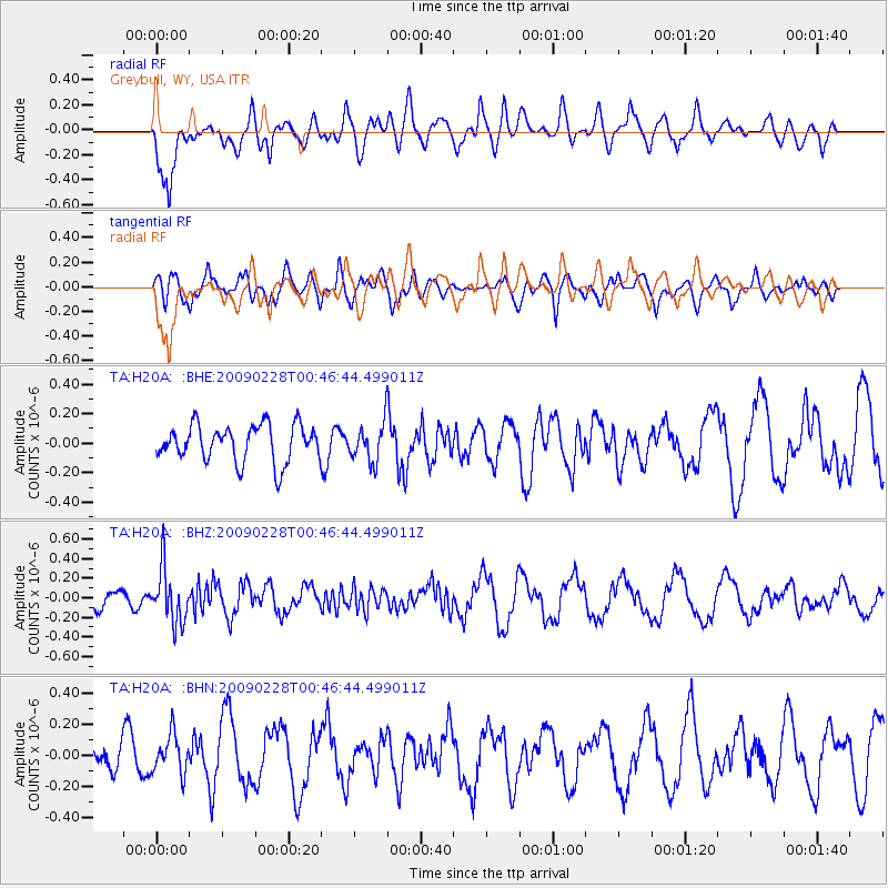
H20A Greybull, WY, USA - Earthquake Result Viewer
*The percent match for this event was below the threshold and hence no stack was calculated.
| Earthquake location: |
Hokkaido, Japan Region |
| Earthquake latitude/longitude: |
42.6/142.1 |
| Earthquake time(UTC): |
2009/02/28 (059) 00:35:56 GMT |
| Earthquake Depth: |
105 km |
| Earthquake Magnitude: |
5.5 MB, 5.5 MW, 5.5 MW |
| Earthquake Catalog/Contributor: |
WHDF/NEIC |
|
| Network: |
TA USArray Transportable Network (new EarthScope stations) |
| Station: |
H20A Greybull, WY, USA |
| Lat/Lon: |
44.49 N/108.00 W |
| Elevation: |
1236 m |
|
| Distance: |
73.1 deg |
| Az: |
44.711 deg |
| Baz: |
313.479 deg |
| Ray Param: |
$rayparam |
*The percent match for this event was below the threshold and hence was not used in the summary stack. |
|
| Radial Match: |
67.31021 % |
| Radial Bump: |
400 |
| Transverse Match: |
69.55772 % |
| Transverse Bump: |
400 |
| SOD ConfigId: |
2658 |
| Insert Time: |
2010-03-06 11:06:45.972 +0000 |
| GWidth: |
2.5 |
| Max Bumps: |
400 |
| Tol: |
0.001 |
|
Signal To Noise
| Channel | StoN | STA | LTA |
| TA:H20A: :BHZ:20090228T00:46:44.499011Z | 2.5654168 | 2.7526534E-7 | 1.0729848E-7 |
| TA:H20A: :BHN:20090228T00:46:44.499011Z | 1.3529067 | 1.2783558E-7 | 9.448957E-8 |
| TA:H20A: :BHE:20090228T00:46:44.499011Z | 1.0579066 | 1.3134961E-7 | 1.2415993E-7 |
| Arrivals |
| Ps | |
| PpPs | |
| PsPs/PpSs | |


