You are here: Home > Network List > TA - USArray Transportable Network (new EarthScope stations) Stations List
> Station H20A Greybull, WY, USA > Earthquake Result Viewer
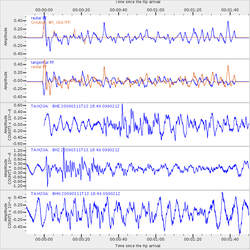
H20A Greybull, WY, USA - Earthquake Result Viewer
*The percent match for this event was below the threshold and hence no stack was calculated.
| Earthquake location: |
San Juan Province, Argentina |
| Earthquake latitude/longitude: |
-31.9/-69.2 |
| Earthquake time(UTC): |
2009/03/11 (070) 13:06:53 GMT |
| Earthquake Depth: |
28 km |
| Earthquake Magnitude: |
5.5 MB, 4.8 MS, 5.3 MW, 5.5 ML |
| Earthquake Catalog/Contributor: |
WHDF/NEIC |
|
| Network: |
TA USArray Transportable Network (new EarthScope stations) |
| Station: |
H20A Greybull, WY, USA |
| Lat/Lon: |
44.49 N/108.00 W |
| Elevation: |
1236 m |
|
| Distance: |
83.8 deg |
| Az: |
333.179 deg |
| Baz: |
147.57 deg |
| Ray Param: |
$rayparam |
*The percent match for this event was below the threshold and hence was not used in the summary stack. |
|
| Radial Match: |
60.36632 % |
| Radial Bump: |
400 |
| Transverse Match: |
64.653175 % |
| Transverse Bump: |
400 |
| SOD ConfigId: |
2658 |
| Insert Time: |
2010-03-06 11:06:55.307 +0000 |
| GWidth: |
2.5 |
| Max Bumps: |
400 |
| Tol: |
0.001 |
|
Signal To Noise
| Channel | StoN | STA | LTA |
| TA:H20A: :BHZ:20090311T13:18:49.099021Z | 2.6210585 | 3.9243758E-7 | 1.4972484E-7 |
| TA:H20A: :BHN:20090311T13:18:49.099021Z | 1.1615024 | 2.2157911E-7 | 1.9076941E-7 |
| TA:H20A: :BHE:20090311T13:18:49.099021Z | 0.94883597 | 1.4808421E-7 | 1.5606933E-7 |
| Arrivals |
| Ps | |
| PpPs | |
| PsPs/PpSs | |


