You are here: Home > Network List > TA - USArray Transportable Network (new EarthScope stations) Stations List
> Station G31M Satah River, YT, CAN > Earthquake Result Viewer
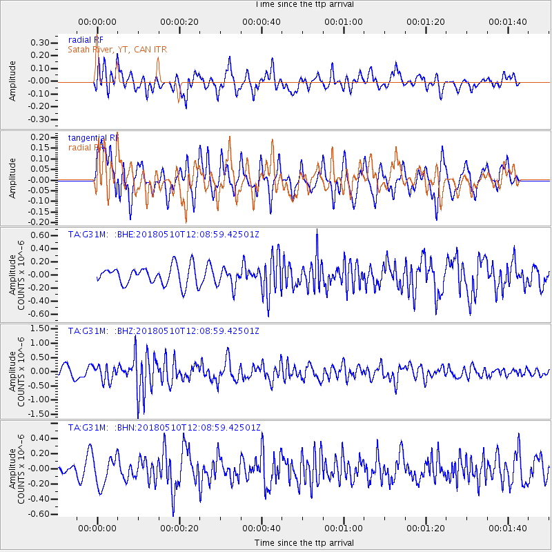
G31M Satah River, YT, CAN - Earthquake Result Viewer
*The percent match for this event was below the threshold and hence no stack was calculated.
| Earthquake location: |
Leyte, Philippines |
| Earthquake latitude/longitude: |
10.2/125.4 |
| Earthquake time(UTC): |
2018/05/10 (130) 11:56:56 GMT |
| Earthquake Depth: |
10 km |
| Earthquake Magnitude: |
5.6 Mww |
| Earthquake Catalog/Contributor: |
NEIC PDE/us |
|
| Network: |
TA USArray Transportable Network (new EarthScope stations) |
| Station: |
G31M Satah River, YT, CAN |
| Lat/Lon: |
66.92 N/134.27 W |
| Elevation: |
61 m |
|
| Distance: |
84.7 deg |
| Az: |
22.924 deg |
| Baz: |
283.402 deg |
| Ray Param: |
$rayparam |
*The percent match for this event was below the threshold and hence was not used in the summary stack. |
|
| Radial Match: |
66.287605 % |
| Radial Bump: |
400 |
| Transverse Match: |
62.39048 % |
| Transverse Bump: |
400 |
| SOD ConfigId: |
13570011 |
| Insert Time: |
2019-04-30 05:57:44.213 +0000 |
| GWidth: |
2.5 |
| Max Bumps: |
400 |
| Tol: |
0.001 |
|
Signal To Noise
| Channel | StoN | STA | LTA |
| TA:G31M: :BHZ:20180510T12:08:59.42501Z | 1.7365752 | 2.6634885E-7 | 1.5337594E-7 |
| TA:G31M: :BHN:20180510T12:08:59.42501Z | 1.8606962 | 1.8966585E-7 | 1.0193274E-7 |
| TA:G31M: :BHE:20180510T12:08:59.42501Z | 0.9973457 | 1.3907444E-7 | 1.3944458E-7 |
| Arrivals |
| Ps | |
| PpPs | |
| PsPs/PpSs | |


