You are here: Home > Network List > TA - USArray Transportable Network (new EarthScope stations) Stations List
> Station H20A Greybull, WY, USA > Earthquake Result Viewer
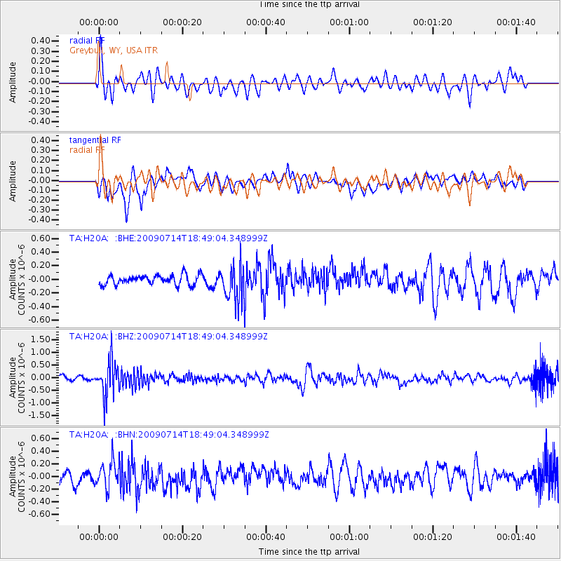
H20A Greybull, WY, USA - Earthquake Result Viewer
*The percent match for this event was below the threshold and hence no stack was calculated.
| Earthquake location: |
Chile-Bolivia Border Region |
| Earthquake latitude/longitude: |
-21.8/-67.1 |
| Earthquake time(UTC): |
2009/07/14 (195) 18:38:08 GMT |
| Earthquake Depth: |
176 km |
| Earthquake Magnitude: |
5.7 MW, 5.4 MB, 5.7 MW |
| Earthquake Catalog/Contributor: |
WHDF/NEIC |
|
| Network: |
TA USArray Transportable Network (new EarthScope stations) |
| Station: |
H20A Greybull, WY, USA |
| Lat/Lon: |
44.49 N/108.00 W |
| Elevation: |
1236 m |
|
| Distance: |
75.8 deg |
| Az: |
331.091 deg |
| Baz: |
141.128 deg |
| Ray Param: |
$rayparam |
*The percent match for this event was below the threshold and hence was not used in the summary stack. |
|
| Radial Match: |
68.1436 % |
| Radial Bump: |
400 |
| Transverse Match: |
69.01305 % |
| Transverse Bump: |
400 |
| SOD ConfigId: |
2648 |
| Insert Time: |
2010-03-06 11:07:19.419 +0000 |
| GWidth: |
2.5 |
| Max Bumps: |
400 |
| Tol: |
0.001 |
|
Signal To Noise
| Channel | StoN | STA | LTA |
| TA:H20A: :BHZ:20090714T18:49:04.348999Z | 10.316905 | 6.9195124E-7 | 6.706966E-8 |
| TA:H20A: :BHN:20090714T18:49:04.348999Z | 2.234004 | 2.0628086E-7 | 9.233683E-8 |
| TA:H20A: :BHE:20090714T18:49:04.348999Z | 3.8179972 | 2.7210402E-7 | 7.1268786E-8 |
| Arrivals |
| Ps | |
| PpPs | |
| PsPs/PpSs | |


