You are here: Home > Network List > TA - USArray Transportable Network (new EarthScope stations) Stations List
> Station H20A Greybull, WY, USA > Earthquake Result Viewer
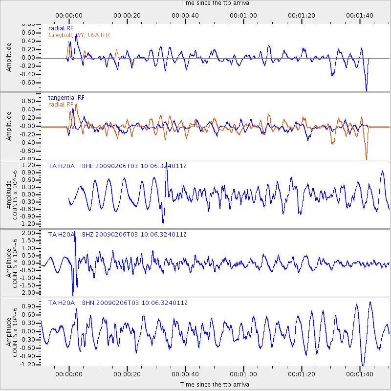
H20A Greybull, WY, USA - Earthquake Result Viewer
*The percent match for this event was below the threshold and hence no stack was calculated.
| Earthquake location: |
Near Coast Of Northern Chile |
| Earthquake latitude/longitude: |
-28.0/-71.1 |
| Earthquake time(UTC): |
2009/02/06 (037) 02:58:35 GMT |
| Earthquake Depth: |
52 km |
| Earthquake Magnitude: |
5.5 MB |
| Earthquake Catalog/Contributor: |
WHDF/NEIC |
|
| Network: |
TA USArray Transportable Network (new EarthScope stations) |
| Station: |
H20A Greybull, WY, USA |
| Lat/Lon: |
44.49 N/108.00 W |
| Elevation: |
1236 m |
|
| Distance: |
79.6 deg |
| Az: |
334.096 deg |
| Baz: |
147.333 deg |
| Ray Param: |
$rayparam |
*The percent match for this event was below the threshold and hence was not used in the summary stack. |
|
| Radial Match: |
60.86891 % |
| Radial Bump: |
400 |
| Transverse Match: |
67.76928 % |
| Transverse Bump: |
400 |
| SOD ConfigId: |
2658 |
| Insert Time: |
2010-03-06 11:07:28.275 +0000 |
| GWidth: |
2.5 |
| Max Bumps: |
400 |
| Tol: |
0.001 |
|
Signal To Noise
| Channel | StoN | STA | LTA |
| TA:H20A: :BHZ:20090206T03:10:06.324011Z | 3.2879438 | 8.8464117E-7 | 2.6905604E-7 |
| TA:H20A: :BHN:20090206T03:10:06.324011Z | 1.3747034 | 4.4475198E-7 | 3.235258E-7 |
| TA:H20A: :BHE:20090206T03:10:06.324011Z | 1.6864241 | 6.4888076E-7 | 3.8476725E-7 |
| Arrivals |
| Ps | |
| PpPs | |
| PsPs/PpSs | |


