You are here: Home > Network List > TA - USArray Transportable Network (new EarthScope stations) Stations List
> Station H20A Greybull, WY, USA > Earthquake Result Viewer
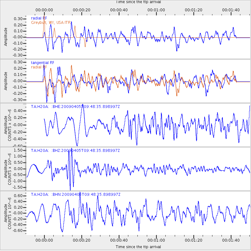
H20A Greybull, WY, USA - Earthquake Result Viewer
*The percent match for this event was below the threshold and hence no stack was calculated.
| Earthquake location: |
Kyushu, Japan |
| Earthquake latitude/longitude: |
32.0/131.4 |
| Earthquake time(UTC): |
2009/04/05 (095) 09:36:26 GMT |
| Earthquake Depth: |
26 km |
| Earthquake Magnitude: |
5.8 MB, 5.4 MS, 5.8 MW, 5.8 MW |
| Earthquake Catalog/Contributor: |
WHDF/NEIC |
|
| Network: |
TA USArray Transportable Network (new EarthScope stations) |
| Station: |
H20A Greybull, WY, USA |
| Lat/Lon: |
44.49 N/108.00 W |
| Elevation: |
1236 m |
|
| Distance: |
86.6 deg |
| Az: |
38.116 deg |
| Baz: |
312.89 deg |
| Ray Param: |
$rayparam |
*The percent match for this event was below the threshold and hence was not used in the summary stack. |
|
| Radial Match: |
60.52525 % |
| Radial Bump: |
400 |
| Transverse Match: |
74.56505 % |
| Transverse Bump: |
400 |
| SOD ConfigId: |
2658 |
| Insert Time: |
2010-03-06 11:07:29.212 +0000 |
| GWidth: |
2.5 |
| Max Bumps: |
400 |
| Tol: |
0.001 |
|
Signal To Noise
| Channel | StoN | STA | LTA |
| TA:H20A: :BHZ:20090405T09:48:35.898997Z | 1.8982661 | 4.236036E-7 | 2.2315292E-7 |
| TA:H20A: :BHN:20090405T09:48:35.898997Z | 1.5799524 | 2.1965533E-7 | 1.3902655E-7 |
| TA:H20A: :BHE:20090405T09:48:35.898997Z | 0.427226 | 1.0445754E-7 | 2.4450185E-7 |
| Arrivals |
| Ps | |
| PpPs | |
| PsPs/PpSs | |


