You are here: Home > Network List > TA - USArray Transportable Network (new EarthScope stations) Stations List
> Station H20A Greybull, WY, USA > Earthquake Result Viewer
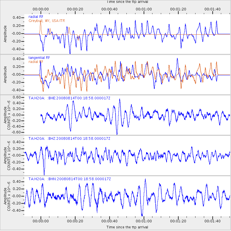
H20A Greybull, WY, USA - Earthquake Result Viewer
*The percent match for this event was below the threshold and hence no stack was calculated.
| Earthquake location: |
Mariana Islands |
| Earthquake latitude/longitude: |
16.4/146.9 |
| Earthquake time(UTC): |
2008/08/14 (227) 00:06:40 GMT |
| Earthquake Depth: |
53 km |
| Earthquake Magnitude: |
5.5 MB, 4.8 MS |
| Earthquake Catalog/Contributor: |
WHDF/NEIC |
|
| Network: |
TA USArray Transportable Network (new EarthScope stations) |
| Station: |
H20A Greybull, WY, USA |
| Lat/Lon: |
44.49 N/108.00 W |
| Elevation: |
1236 m |
|
| Distance: |
89.0 deg |
| Az: |
43.729 deg |
| Baz: |
292.057 deg |
| Ray Param: |
$rayparam |
*The percent match for this event was below the threshold and hence was not used in the summary stack. |
|
| Radial Match: |
54.70724 % |
| Radial Bump: |
400 |
| Transverse Match: |
50.748627 % |
| Transverse Bump: |
400 |
| SOD ConfigId: |
2504 |
| Insert Time: |
2010-03-06 11:07:30.603 +0000 |
| GWidth: |
2.5 |
| Max Bumps: |
400 |
| Tol: |
0.001 |
|
Signal To Noise
| Channel | StoN | STA | LTA |
| TA:H20A: :BHZ:20080814T00:18:58.000017Z | 2.3738894 | 2.2180083E-7 | 9.343351E-8 |
| TA:H20A: :BHN:20080814T00:18:58.000017Z | 1.162156 | 1.668069E-7 | 1.4353229E-7 |
| TA:H20A: :BHE:20080814T00:18:58.000017Z | 0.44252396 | 7.992747E-8 | 1.8061728E-7 |
| Arrivals |
| Ps | |
| PpPs | |
| PsPs/PpSs | |


