You are here: Home > Network List > TA - USArray Transportable Network (new EarthScope stations) Stations List
> Station H20A Greybull, WY, USA > Earthquake Result Viewer
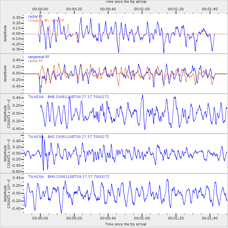
H20A Greybull, WY, USA - Earthquake Result Viewer
*The percent match for this event was below the threshold and hence no stack was calculated.
| Earthquake location: |
Tonga Islands |
| Earthquake latitude/longitude: |
-15.2/-174.2 |
| Earthquake time(UTC): |
2008/11/08 (313) 09:15:51 GMT |
| Earthquake Depth: |
140 km |
| Earthquake Magnitude: |
5.5 MW, 5.3 MB |
| Earthquake Catalog/Contributor: |
WHDF/NEIC |
|
| Network: |
TA USArray Transportable Network (new EarthScope stations) |
| Station: |
H20A Greybull, WY, USA |
| Lat/Lon: |
44.49 N/108.00 W |
| Elevation: |
1236 m |
|
| Distance: |
84.5 deg |
| Az: |
41.15 deg |
| Baz: |
242.562 deg |
| Ray Param: |
$rayparam |
*The percent match for this event was below the threshold and hence was not used in the summary stack. |
|
| Radial Match: |
54.145382 % |
| Radial Bump: |
400 |
| Transverse Match: |
50.78049 % |
| Transverse Bump: |
400 |
| SOD ConfigId: |
2658 |
| Insert Time: |
2010-03-06 11:07:39.012 +0000 |
| GWidth: |
2.5 |
| Max Bumps: |
400 |
| Tol: |
0.001 |
|
Signal To Noise
| Channel | StoN | STA | LTA |
| TA:H20A: :BHZ:20081108T09:27:37.700027Z | 2.9607275 | 2.8017408E-7 | 9.4630145E-8 |
| TA:H20A: :BHN:20081108T09:27:37.700027Z | 0.3892933 | 1.040844E-7 | 2.6736757E-7 |
| TA:H20A: :BHE:20081108T09:27:37.700027Z | 0.49381796 | 9.342158E-8 | 1.8918223E-7 |
| Arrivals |
| Ps | |
| PpPs | |
| PsPs/PpSs | |


