J21A Lysite, WY, USA - Earthquake Result Viewer
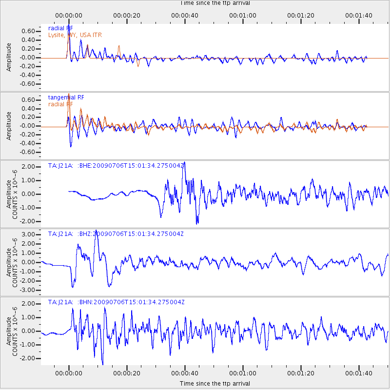
Earthquake location: Rat Islands, Aleutian Islands
Earthquake latitude/longitude: 50.4/177.0
Earthquake time(UTC): 2009/07/06 (187) 14:53:12 GMT
Earthquake Depth: 22 km
Earthquake Magnitude: 6.0 MB, 5.8 MS, 6.1 MW, 6.0 MW
Earthquake Catalog/Contributor: WHDF/NEIC
Network: TA USArray Transportable Network (new EarthScope stations)
Station: J21A Lysite, WY, USA
Lat/Lon: 43.35 N/107.45 W
Elevation: 1913 m
Distance: 50.0 deg
Az: 67.161 deg
Baz: 306.112 deg
Ray Param: 0.06828204
Estimated Moho Depth: 41.25 km
Estimated Crust Vp/Vs: 1.61
Assumed Crust Vp: 6.178 km/s
Estimated Crust Vs: 3.837 km/s
Estimated Crust Poisson's Ratio: 0.19
Radial Match: 81.19206 %
Radial Bump: 400
Transverse Match: 77.78424 %
Transverse Bump: 400
SOD ConfigId: 2648
Insert Time: 2010-03-06 11:08:28.234 +0000
GWidth: 2.5
Max Bumps: 400
Tol: 0.001

Signal To Noise

ChannelStoNSTALTA
TA:J21A: :BHZ:20090706T15:01:34.275004Z6.7775411.4613458E-62.1561593E-7
TA:J21A: :BHN:20090706T15:01:34.275004Z6.8099187.497859E-71.1010204E-7
TA:J21A: :BHE:20090706T15:01:34.275004Z3.52581297.543008E-72.139367E-7
Arrivals
Ps4.3 SECOND
PpPs16 SECOND
PsPs/PpSs21 SECOND