You are here: Home > Network List > TA - USArray Transportable Network (new EarthScope stations) Stations List
> Station M16K Timber Creek, AK, USA > Earthquake Result Viewer
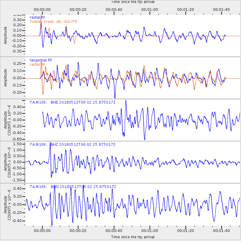
M16K Timber Creek, AK, USA - Earthquake Result Viewer
*The percent match for this event was below the threshold and hence no stack was calculated.
| Earthquake location: |
Tonga Islands |
| Earthquake latitude/longitude: |
-21.2/-173.9 |
| Earthquake time(UTC): |
2018/05/13 (133) 05:50:33 GMT |
| Earthquake Depth: |
10 km |
| Earthquake Magnitude: |
5.6 mb |
| Earthquake Catalog/Contributor: |
NEIC PDE/us |
|
| Network: |
TA USArray Transportable Network (new EarthScope stations) |
| Station: |
M16K Timber Creek, AK, USA |
| Lat/Lon: |
61.02 N/158.96 W |
| Elevation: |
394 m |
|
| Distance: |
82.8 deg |
| Az: |
7.258 deg |
| Baz: |
194.014 deg |
| Ray Param: |
$rayparam |
*The percent match for this event was below the threshold and hence was not used in the summary stack. |
|
| Radial Match: |
68.6522 % |
| Radial Bump: |
400 |
| Transverse Match: |
70.15423 % |
| Transverse Bump: |
400 |
| SOD ConfigId: |
13570011 |
| Insert Time: |
2019-04-30 06:08:22.429 +0000 |
| GWidth: |
2.5 |
| Max Bumps: |
400 |
| Tol: |
0.001 |
|
Signal To Noise
| Channel | StoN | STA | LTA |
| TA:M16K: :BHZ:20180513T06:02:25.875017Z | 4.889514 | 4.9533554E-7 | 1.0130567E-7 |
| TA:M16K: :BHN:20180513T06:02:25.875017Z | 0.9883545 | 1.15247204E-7 | 1.1660513E-7 |
| TA:M16K: :BHE:20180513T06:02:25.875017Z | 0.73192143 | 1.0611955E-7 | 1.4498762E-7 |
| Arrivals |
| Ps | |
| PpPs | |
| PsPs/PpSs | |


