You are here: Home > Network List > UU - University of Utah Regional Network Stations List
> Station FORU South Mineral Mountains, UT, USA > Earthquake Result Viewer
FORU South Mineral Mountains, UT, USA - Earthquake Result Viewer

| Earthquake location: |
Near Coast Of Ecuador |
| Earthquake latitude/longitude: |
0.4/-79.8 |
| Earthquake time(UTC): |
2016/05/18 (139) 07:57:05 GMT |
| Earthquake Depth: |
32 km |
| Earthquake Magnitude: |
6.7 MWP, 6.7 MWW, 6.7 MI |
| Earthquake Catalog/Contributor: |
NEIC PDE/NEIC COMCAT |
|
| Network: |
UU University of Utah Regional Network |
| Station: |
FORU South Mineral Mountains, UT, USA |
| Lat/Lon: |
38.46 N/112.86 W |
| Elevation: |
1840 m |
|
| Distance: |
48.5 deg |
| Az: |
325.099 deg |
| Baz: |
133.216 deg |
| Ray Param: |
0.06923932 |
| Estimated Moho Depth: |
25.0 km |
| Estimated Crust Vp/Vs: |
1.60 |
| Assumed Crust Vp: |
6.276 km/s |
| Estimated Crust Vs: |
3.922 km/s |
| Estimated Crust Poisson's Ratio: |
0.18 |
|
| Radial Match: |
82.33268 % |
| Radial Bump: |
400 |
| Transverse Match: |
66.014206 % |
| Transverse Bump: |
400 |
| SOD ConfigId: |
1475611 |
| Insert Time: |
2016-06-01 08:19:17.656 +0000 |
| GWidth: |
2.5 |
| Max Bumps: |
400 |
| Tol: |
0.001 |
|
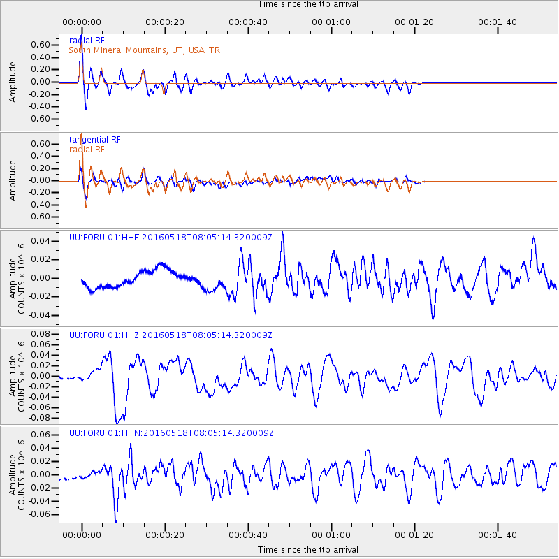
Signal To Noise
| Channel | StoN | STA | LTA |
| UU:FORU:01:HHZ:20160518T08:05:14.320009Z | 3.9910467 | 1.0371642E-8 | 2.5987275E-9 |
| UU:FORU:01:HHN:20160518T08:05:14.320009Z | 0.9685441 | 4.0814605E-9 | 4.214016E-9 |
| UU:FORU:01:HHE:20160518T08:05:14.320009Z | 1.2151688 | 1.0909874E-8 | 8.978072E-9 |
| Arrivals |
| Ps | 2.5 SECOND |
| PpPs | 9.7 SECOND |
| PsPs/PpSs | 12 SECOND |


