You are here: Home > Network List > TA - USArray Transportable Network (new EarthScope stations) Stations List
> Station J21A Lysite, WY, USA > Earthquake Result Viewer
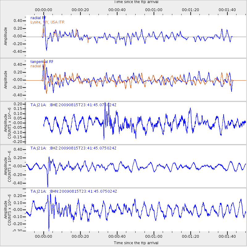
J21A Lysite, WY, USA - Earthquake Result Viewer
*The percent match for this event was below the threshold and hence no stack was calculated.
| Earthquake location: |
Fiji Islands Region |
| Earthquake latitude/longitude: |
-19.8/-178.2 |
| Earthquake time(UTC): |
2009/08/15 (227) 23:30:19 GMT |
| Earthquake Depth: |
608 km |
| Earthquake Magnitude: |
5.6 MW, 5.2 MB |
| Earthquake Catalog/Contributor: |
WHDF/NEIC |
|
| Network: |
TA USArray Transportable Network (new EarthScope stations) |
| Station: |
J21A Lysite, WY, USA |
| Lat/Lon: |
43.35 N/107.45 W |
| Elevation: |
1913 m |
|
| Distance: |
90.3 deg |
| Az: |
43.545 deg |
| Baz: |
242.755 deg |
| Ray Param: |
$rayparam |
*The percent match for this event was below the threshold and hence was not used in the summary stack. |
|
| Radial Match: |
50.567398 % |
| Radial Bump: |
400 |
| Transverse Match: |
49.33201 % |
| Transverse Bump: |
400 |
| SOD ConfigId: |
2622 |
| Insert Time: |
2010-03-06 11:09:02.951 +0000 |
| GWidth: |
2.5 |
| Max Bumps: |
400 |
| Tol: |
0.001 |
|
Signal To Noise
| Channel | StoN | STA | LTA |
| TA:J21A: :BHZ:20090815T23:41:45.075024Z | 2.583269 | 1.4544285E-7 | 5.6301865E-8 |
| TA:J21A: :BHN:20090815T23:41:45.075024Z | 1.6835055 | 1.2419393E-7 | 7.377103E-8 |
| TA:J21A: :BHE:20090815T23:41:45.075024Z | 1.3726487 | 7.487864E-8 | 5.455048E-8 |
| Arrivals |
| Ps | |
| PpPs | |
| PsPs/PpSs | |


