You are here: Home > Network List > TA - USArray Transportable Network (new EarthScope stations) Stations List
> Station J21A Lysite, WY, USA > Earthquake Result Viewer
J21A Lysite, WY, USA - Earthquake Result Viewer
*The percent match for this event was below the threshold and hence no stack was calculated.
| Earthquake location: |
Norwegian Sea |
| Earthquake latitude/longitude: |
72.2/0.9 |
| Earthquake time(UTC): |
2009/08/20 (232) 06:35:04 GMT |
| Earthquake Depth: |
6.0 km |
| Earthquake Magnitude: |
5.9 MB, 5.7 MS, 6.0 MW, 6.0 MW |
| Earthquake Catalog/Contributor: |
WHDF/NEIC |
|
| Network: |
TA USArray Transportable Network (new EarthScope stations) |
| Station: |
J21A Lysite, WY, USA |
| Lat/Lon: |
43.35 N/107.45 W |
| Elevation: |
1913 m |
|
| Distance: |
54.5 deg |
| Az: |
301.808 deg |
| Baz: |
20.995 deg |
| Ray Param: |
$rayparam |
*The percent match for this event was below the threshold and hence was not used in the summary stack. |
|
| Radial Match: |
75.97682 % |
| Radial Bump: |
400 |
| Transverse Match: |
59.306633 % |
| Transverse Bump: |
400 |
| SOD ConfigId: |
2622 |
| Insert Time: |
2010-03-06 11:09:07.296 +0000 |
| GWidth: |
2.5 |
| Max Bumps: |
400 |
| Tol: |
0.001 |
|
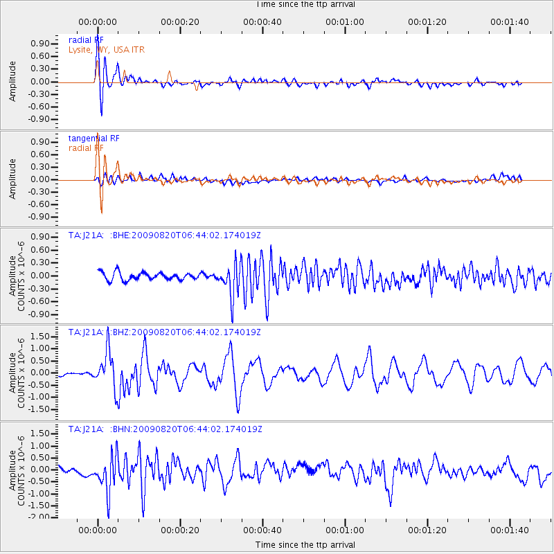
Signal To Noise
| Channel | StoN | STA | LTA |
| TA:J21A: :BHZ:20090820T06:44:02.174019Z | 15.918506 | 7.942597E-7 | 4.989537E-8 |
| TA:J21A: :BHN:20090820T06:44:02.174019Z | 4.6085863 | 8.1682987E-7 | 1.7724086E-7 |
| TA:J21A: :BHE:20090820T06:44:02.174019Z | 4.4016547 | 3.8589675E-7 | 8.7670834E-8 |
| Arrivals |
| Ps | |
| PpPs | |
| PsPs/PpSs | |


