You are here: Home > Network List > TA - USArray Transportable Network (new EarthScope stations) Stations List
> Station J21A Lysite, WY, USA > Earthquake Result Viewer
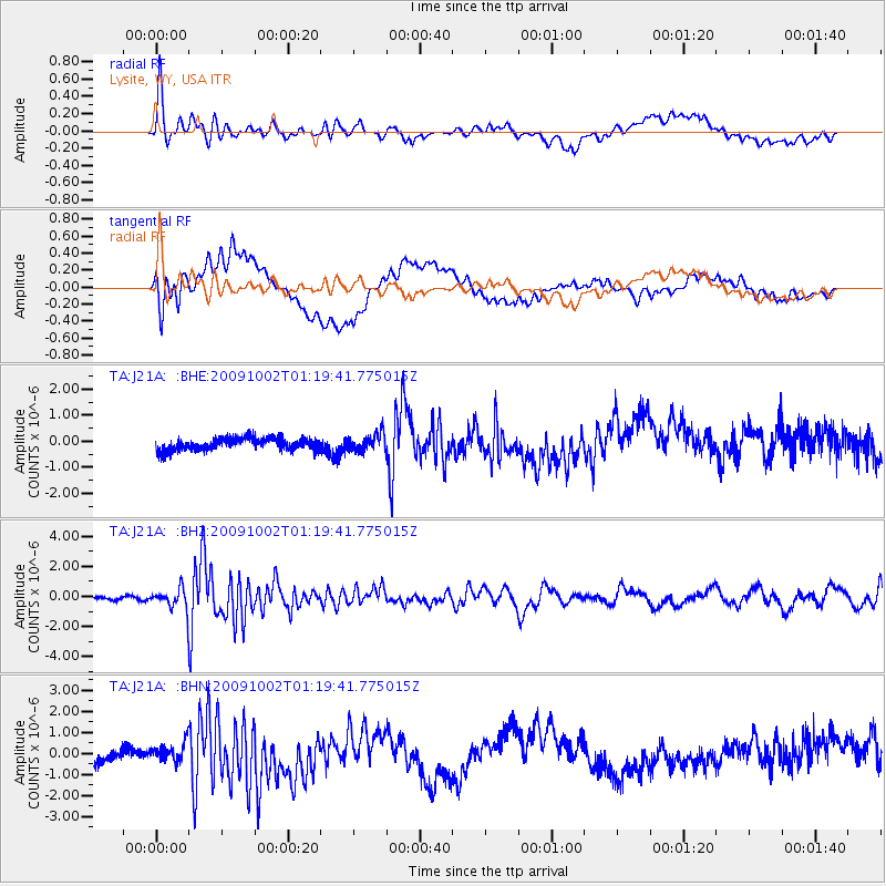
J21A Lysite, WY, USA - Earthquake Result Viewer
*The percent match for this event was below the threshold and hence no stack was calculated.
| Earthquake location: |
Tonga Islands |
| Earthquake latitude/longitude: |
-16.3/-173.5 |
| Earthquake time(UTC): |
2009/10/02 (275) 01:07:39 GMT |
| Earthquake Depth: |
8.0 km |
| Earthquake Magnitude: |
6.1 MB, 6.0 MS, 6.1 MW, 6.1 MW |
| Earthquake Catalog/Contributor: |
WHDF/NEIC |
|
| Network: |
TA USArray Transportable Network (new EarthScope stations) |
| Station: |
J21A Lysite, WY, USA |
| Lat/Lon: |
43.35 N/107.45 W |
| Elevation: |
1913 m |
|
| Distance: |
84.6 deg |
| Az: |
42.029 deg |
| Baz: |
241.782 deg |
| Ray Param: |
$rayparam |
*The percent match for this event was below the threshold and hence was not used in the summary stack. |
|
| Radial Match: |
55.14533 % |
| Radial Bump: |
400 |
| Transverse Match: |
60.11699 % |
| Transverse Bump: |
400 |
| SOD ConfigId: |
2622 |
| Insert Time: |
2010-03-06 11:09:17.646 +0000 |
| GWidth: |
2.5 |
| Max Bumps: |
400 |
| Tol: |
0.001 |
|
Signal To Noise
| Channel | StoN | STA | LTA |
| TA:J21A: :BHZ:20091002T01:19:41.775015Z | 6.0899973 | 6.473449E-7 | 1.0629642E-7 |
| TA:J21A: :BHN:20091002T01:19:41.775015Z | 0.65370953 | 4.762038E-7 | 7.284639E-7 |
| TA:J21A: :BHE:20091002T01:19:41.775015Z | 1.4598961 | 3.3777584E-7 | 2.3136978E-7 |
| Arrivals |
| Ps | |
| PpPs | |
| PsPs/PpSs | |


