You are here: Home > Network List > TA - USArray Transportable Network (new EarthScope stations) Stations List
> Station J21A Lysite, WY, USA > Earthquake Result Viewer
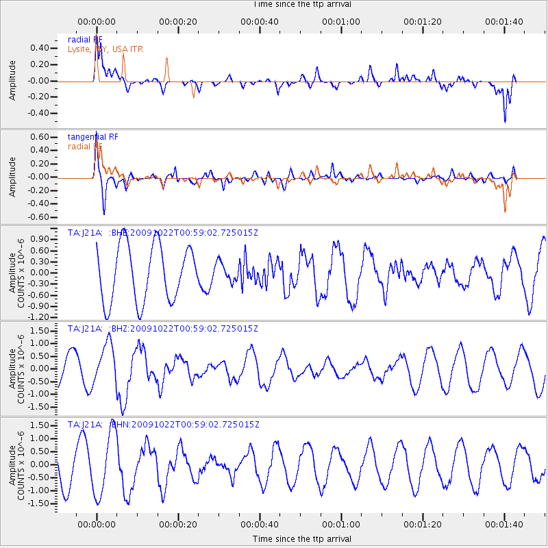
J21A Lysite, WY, USA - Earthquake Result Viewer
*The percent match for this event was below the threshold and hence no stack was calculated.
| Earthquake location: |
South Of Panama |
| Earthquake latitude/longitude: |
6.7/-82.6 |
| Earthquake time(UTC): |
2009/10/22 (295) 00:51:39 GMT |
| Earthquake Depth: |
18 km |
| Earthquake Magnitude: |
5.5 MB, 5.4 MS, 5.9 MW, 5.9 MW |
| Earthquake Catalog/Contributor: |
WHDF/NEIC |
|
| Network: |
TA USArray Transportable Network (new EarthScope stations) |
| Station: |
J21A Lysite, WY, USA |
| Lat/Lon: |
43.35 N/107.45 W |
| Elevation: |
1913 m |
|
| Distance: |
42.5 deg |
| Az: |
333.007 deg |
| Baz: |
141.835 deg |
| Ray Param: |
$rayparam |
*The percent match for this event was below the threshold and hence was not used in the summary stack. |
|
| Radial Match: |
83.906334 % |
| Radial Bump: |
380 |
| Transverse Match: |
66.79175 % |
| Transverse Bump: |
400 |
| SOD ConfigId: |
2622 |
| Insert Time: |
2010-03-06 11:09:29.512 +0000 |
| GWidth: |
2.5 |
| Max Bumps: |
400 |
| Tol: |
0.001 |
|
Signal To Noise
| Channel | StoN | STA | LTA |
| TA:J21A: :BHZ:20091022T00:59:02.725015Z | 0.7641735 | 7.956897E-7 | 1.0412422E-6 |
| TA:J21A: :BHN:20091022T00:59:02.725015Z | 2.560964 | 1.2513443E-6 | 4.8862233E-7 |
| TA:J21A: :BHE:20091022T00:59:02.725015Z | 0.33771497 | 2.5323203E-7 | 7.498395E-7 |
| Arrivals |
| Ps | |
| PpPs | |
| PsPs/PpSs | |


