You are here: Home > Network List > TA - USArray Transportable Network (new EarthScope stations) Stations List
> Station J21A Lysite, WY, USA > Earthquake Result Viewer
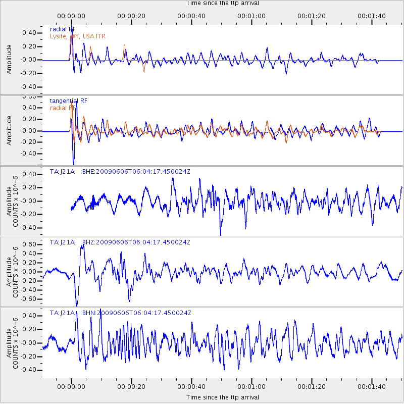
J21A Lysite, WY, USA - Earthquake Result Viewer
*The percent match for this event was below the threshold and hence no stack was calculated.
| Earthquake location: |
Near East Coast Of Honshu, Japan |
| Earthquake latitude/longitude: |
35.5/140.9 |
| Earthquake time(UTC): |
2009/06/06 (157) 05:52:43 GMT |
| Earthquake Depth: |
34 km |
| Earthquake Magnitude: |
5.8 MB, 5.4 MS, 5.8 MW, 5.7 MW |
| Earthquake Catalog/Contributor: |
WHDF/NEIC |
|
| Network: |
TA USArray Transportable Network (new EarthScope stations) |
| Station: |
J21A Lysite, WY, USA |
| Lat/Lon: |
43.35 N/107.45 W |
| Elevation: |
1913 m |
|
| Distance: |
79.9 deg |
| Az: |
43.536 deg |
| Baz: |
309.593 deg |
| Ray Param: |
$rayparam |
*The percent match for this event was below the threshold and hence was not used in the summary stack. |
|
| Radial Match: |
67.348495 % |
| Radial Bump: |
400 |
| Transverse Match: |
67.91012 % |
| Transverse Bump: |
400 |
| SOD ConfigId: |
2648 |
| Insert Time: |
2010-03-06 11:09:44.157 +0000 |
| GWidth: |
2.5 |
| Max Bumps: |
400 |
| Tol: |
0.001 |
|
Signal To Noise
| Channel | StoN | STA | LTA |
| TA:J21A: :BHZ:20090606T06:04:17.450024Z | 7.141541 | 3.9943174E-7 | 5.5930748E-8 |
| TA:J21A: :BHN:20090606T06:04:17.450024Z | 3.2648082 | 1.8852691E-7 | 5.7745172E-8 |
| TA:J21A: :BHE:20090606T06:04:17.450024Z | 1.9624275 | 1.6080577E-7 | 8.1942275E-8 |
| Arrivals |
| Ps | |
| PpPs | |
| PsPs/PpSs | |


