You are here: Home > Network List > TA - USArray Transportable Network (new EarthScope stations) Stations List
> Station J21A Lysite, WY, USA > Earthquake Result Viewer
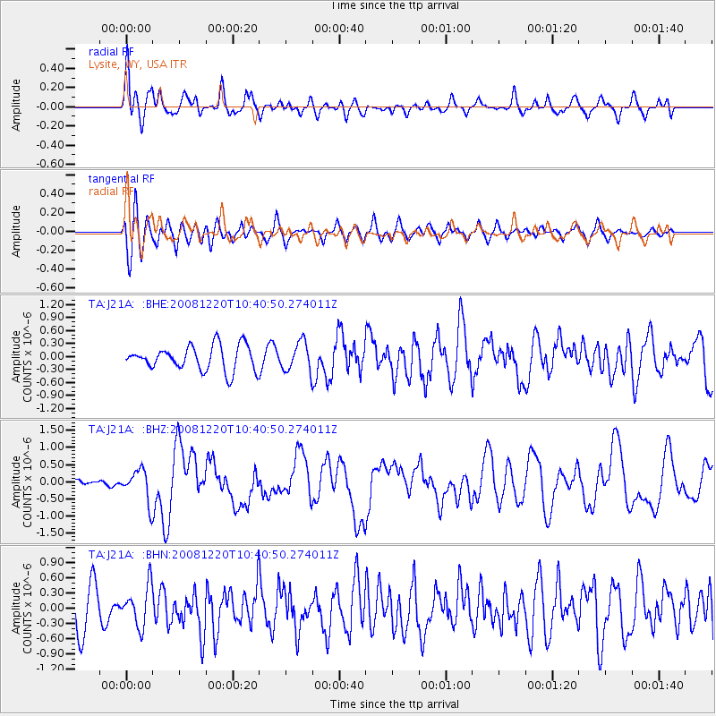
J21A Lysite, WY, USA - Earthquake Result Viewer
*The percent match for this event was below the threshold and hence no stack was calculated.
| Earthquake location: |
Off East Coast Of Honshu, Japan |
| Earthquake latitude/longitude: |
36.5/142.4 |
| Earthquake time(UTC): |
2008/12/20 (355) 10:29:23 GMT |
| Earthquake Depth: |
19 km |
| Earthquake Magnitude: |
6.0 MB, 6.3 MS, 6.3 MW, 6.3 MW |
| Earthquake Catalog/Contributor: |
WHDF/NEIC |
|
| Network: |
TA USArray Transportable Network (new EarthScope stations) |
| Station: |
J21A Lysite, WY, USA |
| Lat/Lon: |
43.35 N/107.45 W |
| Elevation: |
1913 m |
|
| Distance: |
78.3 deg |
| Az: |
44.392 deg |
| Baz: |
309.442 deg |
| Ray Param: |
$rayparam |
*The percent match for this event was below the threshold and hence was not used in the summary stack. |
|
| Radial Match: |
71.49977 % |
| Radial Bump: |
400 |
| Transverse Match: |
65.856575 % |
| Transverse Bump: |
400 |
| SOD ConfigId: |
2658 |
| Insert Time: |
2010-03-06 11:09:59.548 +0000 |
| GWidth: |
2.5 |
| Max Bumps: |
400 |
| Tol: |
0.001 |
|
Signal To Noise
| Channel | StoN | STA | LTA |
| TA:J21A: :BHZ:20081220T10:40:50.274011Z | 2.9915369 | 4.6851292E-7 | 1.5661278E-7 |
| TA:J21A: :BHN:20081220T10:40:50.274011Z | 0.99382573 | 3.9844332E-7 | 4.0091868E-7 |
| TA:J21A: :BHE:20081220T10:40:50.274011Z | 1.1988789 | 3.3829085E-7 | 2.8217264E-7 |
| Arrivals |
| Ps | |
| PpPs | |
| PsPs/PpSs | |


