You are here: Home > Network List > TA - USArray Transportable Network (new EarthScope stations) Stations List
> Station J21A Lysite, WY, USA > Earthquake Result Viewer
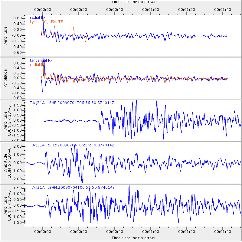
J21A Lysite, WY, USA - Earthquake Result Viewer
*The percent match for this event was below the threshold and hence no stack was calculated.
| Earthquake location: |
Panama |
| Earthquake latitude/longitude: |
9.6/-79.0 |
| Earthquake time(UTC): |
2009/07/04 (185) 06:49:35 GMT |
| Earthquake Depth: |
38 km |
| Earthquake Magnitude: |
6.0 MB, 5.5 MS, 6.0 MW, 6.0 MW |
| Earthquake Catalog/Contributor: |
WHDF/NEIC |
|
| Network: |
TA USArray Transportable Network (new EarthScope stations) |
| Station: |
J21A Lysite, WY, USA |
| Lat/Lon: |
43.35 N/107.45 W |
| Elevation: |
1913 m |
|
| Distance: |
41.8 deg |
| Az: |
328.532 deg |
| Baz: |
135.114 deg |
| Ray Param: |
$rayparam |
*The percent match for this event was below the threshold and hence was not used in the summary stack. |
|
| Radial Match: |
86.67566 % |
| Radial Bump: |
400 |
| Transverse Match: |
85.33089 % |
| Transverse Bump: |
400 |
| SOD ConfigId: |
2648 |
| Insert Time: |
2010-03-06 11:10:01.000 +0000 |
| GWidth: |
2.5 |
| Max Bumps: |
400 |
| Tol: |
0.001 |
|
Signal To Noise
| Channel | StoN | STA | LTA |
| TA:J21A: :BHZ:20090704T06:56:50.874014Z | 8.822454 | 7.3647743E-7 | 8.3477616E-8 |
| TA:J21A: :BHN:20090704T06:56:50.874014Z | 9.20122 | 4.6220134E-7 | 5.0232615E-8 |
| TA:J21A: :BHE:20090704T06:56:50.874014Z | 7.46133 | 4.40187E-7 | 5.8995784E-8 |
| Arrivals |
| Ps | |
| PpPs | |
| PsPs/PpSs | |


