You are here: Home > Network List > TA - USArray Transportable Network (new EarthScope stations) Stations List
> Station J21A Lysite, WY, USA > Earthquake Result Viewer
J21A Lysite, WY, USA - Earthquake Result Viewer
*The percent match for this event was below the threshold and hence no stack was calculated.
| Earthquake location: |
Guatemala |
| Earthquake latitude/longitude: |
14.6/-91.2 |
| Earthquake time(UTC): |
2009/05/03 (123) 16:21:47 GMT |
| Earthquake Depth: |
124 km |
| Earthquake Magnitude: |
5.6 MB, 6.2 MW, 6.2 MW |
| Earthquake Catalog/Contributor: |
WHDF/NEIC |
|
| Network: |
TA USArray Transportable Network (new EarthScope stations) |
| Station: |
J21A Lysite, WY, USA |
| Lat/Lon: |
43.35 N/107.45 W |
| Elevation: |
1913 m |
|
| Distance: |
31.9 deg |
| Az: |
337.232 deg |
| Baz: |
149.093 deg |
| Ray Param: |
$rayparam |
*The percent match for this event was below the threshold and hence was not used in the summary stack. |
|
| Radial Match: |
85.637634 % |
| Radial Bump: |
329 |
| Transverse Match: |
75.471016 % |
| Transverse Bump: |
400 |
| SOD ConfigId: |
2658 |
| Insert Time: |
2010-03-06 11:10:31.104 +0000 |
| GWidth: |
2.5 |
| Max Bumps: |
400 |
| Tol: |
0.001 |
|
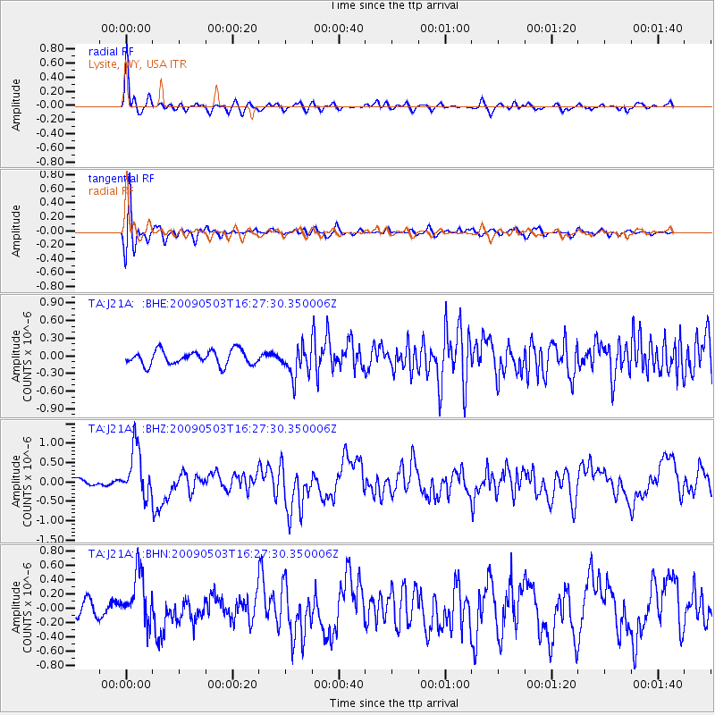
Signal To Noise
| Channel | StoN | STA | LTA |
| TA:J21A: :BHZ:20090503T16:27:30.350006Z | 6.0038047 | 6.442362E-7 | 1.0730465E-7 |
| TA:J21A: :BHN:20090503T16:27:30.350006Z | 4.3316503 | 3.7389833E-7 | 8.631776E-8 |
| TA:J21A: :BHE:20090503T16:27:30.350006Z | 2.1012628 | 2.529013E-7 | 1.203568E-7 |
| Arrivals |
| Ps | |
| PpPs | |
| PsPs/PpSs | |


