You are here: Home > Network List > TA - USArray Transportable Network (new EarthScope stations) Stations List
> Station J21A Lysite, WY, USA > Earthquake Result Viewer
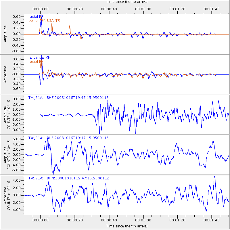
J21A Lysite, WY, USA - Earthquake Result Viewer
*The percent match for this event was below the threshold and hence no stack was calculated.
| Earthquake location: |
Near Coast Of Chiapas, Mexico |
| Earthquake latitude/longitude: |
14.4/-92.4 |
| Earthquake time(UTC): |
2008/10/16 (290) 19:41:25 GMT |
| Earthquake Depth: |
24 km |
| Earthquake Magnitude: |
6.1 MB, 6.6 MS, 6.7 MW, 6.6 MW |
| Earthquake Catalog/Contributor: |
WHDF/NEIC |
|
| Network: |
TA USArray Transportable Network (new EarthScope stations) |
| Station: |
J21A Lysite, WY, USA |
| Lat/Lon: |
43.35 N/107.45 W |
| Elevation: |
1913 m |
|
| Distance: |
31.6 deg |
| Az: |
338.758 deg |
| Baz: |
151.237 deg |
| Ray Param: |
$rayparam |
*The percent match for this event was below the threshold and hence was not used in the summary stack. |
|
| Radial Match: |
94.8869 % |
| Radial Bump: |
323 |
| Transverse Match: |
81.79141 % |
| Transverse Bump: |
400 |
| SOD ConfigId: |
2556 |
| Insert Time: |
2010-03-06 11:10:37.029 +0000 |
| GWidth: |
2.5 |
| Max Bumps: |
400 |
| Tol: |
0.001 |
|
Signal To Noise
| Channel | StoN | STA | LTA |
| TA:J21A: :BHZ:20081016T19:47:15.950011Z | 14.848617 | 2.9345226E-6 | 1.9762936E-7 |
| TA:J21A: :BHN:20081016T19:47:15.950011Z | 6.620998 | 1.5318163E-6 | 2.3135732E-7 |
| TA:J21A: :BHE:20081016T19:47:15.950011Z | 7.933645 | 1.2450226E-6 | 1.5692947E-7 |
| Arrivals |
| Ps | |
| PpPs | |
| PsPs/PpSs | |


