You are here: Home > Network List > TA - USArray Transportable Network (new EarthScope stations) Stations List
> Station J21A Lysite, WY, USA > Earthquake Result Viewer
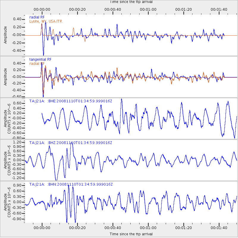
J21A Lysite, WY, USA - Earthquake Result Viewer
*The percent match for this event was below the threshold and hence no stack was calculated.
| Earthquake location: |
Qinghai, China |
| Earthquake latitude/longitude: |
37.6/95.8 |
| Earthquake time(UTC): |
2008/11/10 (315) 01:22:02 GMT |
| Earthquake Depth: |
19 km |
| Earthquake Magnitude: |
6.4 MB, 6.4 MS, 6.3 MW, 6.3 MW |
| Earthquake Catalog/Contributor: |
WHDF/NEIC |
|
| Network: |
TA USArray Transportable Network (new EarthScope stations) |
| Station: |
J21A Lysite, WY, USA |
| Lat/Lon: |
43.35 N/107.45 W |
| Elevation: |
1913 m |
|
| Distance: |
96.7 deg |
| Az: |
16.877 deg |
| Baz: |
341.565 deg |
| Ray Param: |
$rayparam |
*The percent match for this event was below the threshold and hence was not used in the summary stack. |
|
| Radial Match: |
78.828064 % |
| Radial Bump: |
400 |
| Transverse Match: |
79.95118 % |
| Transverse Bump: |
400 |
| SOD ConfigId: |
2658 |
| Insert Time: |
2010-03-06 11:10:50.697 +0000 |
| GWidth: |
2.5 |
| Max Bumps: |
400 |
| Tol: |
0.001 |
|
Signal To Noise
| Channel | StoN | STA | LTA |
| TA:J21A: :BHZ:20081110T01:34:59.999016Z | 1.9144553 | 5.2005936E-7 | 2.7164873E-7 |
| TA:J21A: :BHN:20081110T01:34:59.999016Z | 0.66892946 | 1.8819573E-7 | 2.8133869E-7 |
| TA:J21A: :BHE:20081110T01:34:59.999016Z | 1.0765384 | 2.4962242E-7 | 2.3187505E-7 |
| Arrivals |
| Ps | |
| PpPs | |
| PsPs/PpSs | |


