You are here: Home > Network List > TA - USArray Transportable Network (new EarthScope stations) Stations List
> Station H31M Peel River, Yukon, CAN > Earthquake Result Viewer
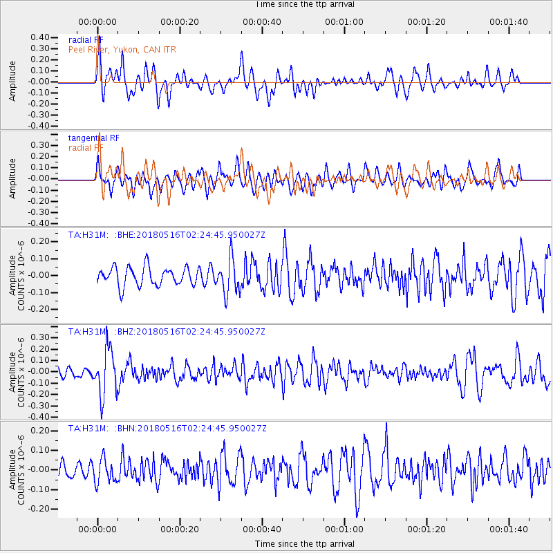
H31M Peel River, Yukon, CAN - Earthquake Result Viewer
*The percent match for this event was below the threshold and hence no stack was calculated.
| Earthquake location: |
Irian Jaya, Indonesia |
| Earthquake latitude/longitude: |
-3.8/138.6 |
| Earthquake time(UTC): |
2018/05/16 (136) 02:12:17 GMT |
| Earthquake Depth: |
88 km |
| Earthquake Magnitude: |
5.4 Mww |
| Earthquake Catalog/Contributor: |
NEIC PDE/us |
|
| Network: |
TA USArray Transportable Network (new EarthScope stations) |
| Station: |
H31M Peel River, Yukon, CAN |
| Lat/Lon: |
65.81 N/134.34 W |
| Elevation: |
642 m |
|
| Distance: |
92.2 deg |
| Az: |
24.324 deg |
| Baz: |
265.766 deg |
| Ray Param: |
$rayparam |
*The percent match for this event was below the threshold and hence was not used in the summary stack. |
|
| Radial Match: |
48.19903 % |
| Radial Bump: |
400 |
| Transverse Match: |
58.797672 % |
| Transverse Bump: |
400 |
| SOD ConfigId: |
13570011 |
| Insert Time: |
2019-04-30 06:20:58.680 +0000 |
| GWidth: |
2.5 |
| Max Bumps: |
400 |
| Tol: |
0.001 |
|
Signal To Noise
| Channel | StoN | STA | LTA |
| TA:H31M: :BHZ:20180516T02:24:45.950027Z | 3.6206346 | 2.1157898E-7 | 5.843699E-8 |
| TA:H31M: :BHN:20180516T02:24:45.950027Z | 1.0252769 | 6.09883E-8 | 5.9484712E-8 |
| TA:H31M: :BHE:20180516T02:24:45.950027Z | 1.940205 | 1.0550329E-7 | 5.437739E-8 |
| Arrivals |
| Ps | |
| PpPs | |
| PsPs/PpSs | |


