
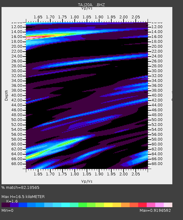
J20A Shoshoni, WY, USA - Earthquake Result Viewer
| ||||||||||||||||||
| ||||||||||||||||||
| ||||||||||||||||||
|
Signal To Noise
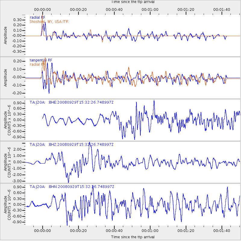
| Channel | StoN | STA | LTA |
| TA:J20A: :BHZ:20080929T15:32:26.748997Z | 3.4020689 | 4.456745E-7 | 1.3100102E-7 |
| TA:J20A: :BHN:20080929T15:32:26.748997Z | 0.6632495 | 6.483937E-8 | 9.776016E-8 |
| TA:J20A: :BHE:20080929T15:32:26.748997Z | 1.5061951 | 2.1432047E-7 | 1.4229265E-7 |
| Arrivals | |
| Ps | 1.6 SECOND |
| PpPs | 6.8 SECOND |
| PsPs/PpSs | 8.5 SECOND |

