J20A Shoshoni, WY, USA - Earthquake Result Viewer
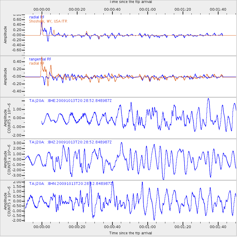
Earthquake location: Fox Islands, Aleutian Islands
Earthquake latitude/longitude: 52.6/-167.1
Earthquake time(UTC): 2009/10/13 (286) 20:21:53 GMT
Earthquake Depth: 14 km
Earthquake Magnitude: 5.9 MB, 6.4 MS, 6.4 MW, 6.4 MW
Earthquake Catalog/Contributor: WHDF/NEIC
Network: TA USArray Transportable Network (new EarthScope stations)
Station: J20A Shoshoni, WY, USA
Lat/Lon: 43.35 N/108.08 W
Elevation: 1500 m
Distance: 39.6 deg
Az: 79.16 deg
Baz: 304.795 deg
Ray Param: 0.07490604
Estimated Moho Depth: 27.0 km
Estimated Crust Vp/Vs: 2.10
Assumed Crust Vp: 6.161 km/s
Estimated Crust Vs: 2.937 km/s
Estimated Crust Poisson's Ratio: 0.35
Radial Match: 81.9569 %
Radial Bump: 378
Transverse Match: 64.52911 %
Transverse Bump: 400
SOD ConfigId: 2622
Insert Time: 2010-03-06 11:11:31.539 +0000
GWidth: 2.5
Max Bumps: 400
Tol: 0.001

Signal To Noise

ChannelStoNSTALTA
TA:J20A: :BHZ:20091013T20:28:52.848987Z2.80706269.816903E-73.4972155E-7
TA:J20A: :BHN:20091013T20:28:52.848987Z0.88588773.6527598E-74.1232767E-7
TA:J20A: :BHE:20091013T20:28:52.848987Z1.26710384.968641E-73.9212583E-7
Arrivals
Ps5.1 SECOND
PpPs13 SECOND
PsPs/PpSs18 SECOND