You are here: Home > Network List > TJ - Tajikistan National Seismic Network Stations List
> Station GARM Garm, Tajikistan > Earthquake Result Viewer
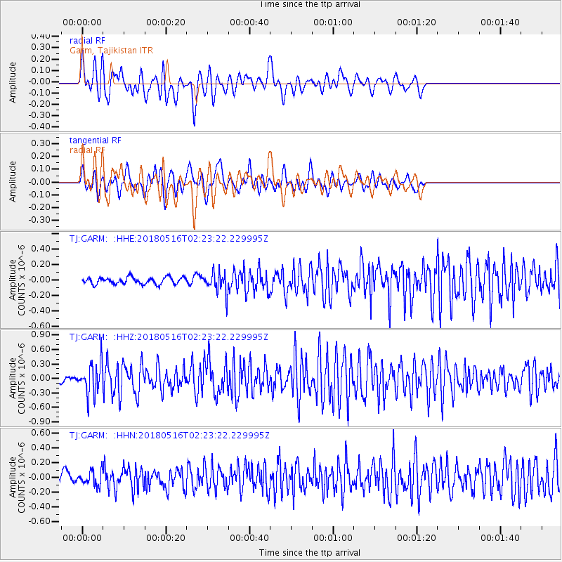
GARM Garm, Tajikistan - Earthquake Result Viewer
*The percent match for this event was below the threshold and hence no stack was calculated.
| Earthquake location: |
Irian Jaya, Indonesia |
| Earthquake latitude/longitude: |
-3.8/138.6 |
| Earthquake time(UTC): |
2018/05/16 (136) 02:12:17 GMT |
| Earthquake Depth: |
88 km |
| Earthquake Magnitude: |
5.4 Mww |
| Earthquake Catalog/Contributor: |
NEIC PDE/us |
|
| Network: |
TJ Tajikistan National Seismic Network |
| Station: |
GARM Garm, Tajikistan |
| Lat/Lon: |
39.00 N/70.32 E |
| Elevation: |
1305 m |
|
| Distance: |
75.7 deg |
| Az: |
311.672 deg |
| Baz: |
106.954 deg |
| Ray Param: |
$rayparam |
*The percent match for this event was below the threshold and hence was not used in the summary stack. |
|
| Radial Match: |
79.29671 % |
| Radial Bump: |
400 |
| Transverse Match: |
69.14428 % |
| Transverse Bump: |
400 |
| SOD ConfigId: |
13570011 |
| Insert Time: |
2019-04-30 06:22:11.862 +0000 |
| GWidth: |
2.5 |
| Max Bumps: |
400 |
| Tol: |
0.001 |
|
Signal To Noise
| Channel | StoN | STA | LTA |
| TJ:GARM: :HHZ:20180516T02:23:22.229995Z | 5.881751 | 3.348722E-7 | 5.69341E-8 |
| TJ:GARM: :HHN:20180516T02:23:22.229995Z | 1.9707298 | 9.8465264E-8 | 4.996386E-8 |
| TJ:GARM: :HHE:20180516T02:23:22.229995Z | 3.0244524 | 1.3038975E-7 | 4.3111854E-8 |
| Arrivals |
| Ps | |
| PpPs | |
| PsPs/PpSs | |


