J20A Shoshoni, WY, USA - Earthquake Result Viewer
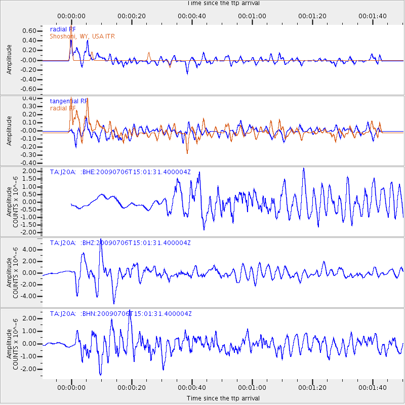
Earthquake location: Rat Islands, Aleutian Islands
Earthquake latitude/longitude: 50.4/177.0
Earthquake time(UTC): 2009/07/06 (187) 14:53:12 GMT
Earthquake Depth: 22 km
Earthquake Magnitude: 6.0 MB, 5.8 MS, 6.1 MW, 6.0 MW
Earthquake Catalog/Contributor: WHDF/NEIC
Network: TA USArray Transportable Network (new EarthScope stations)
Station: J20A Shoshoni, WY, USA
Lat/Lon: 43.35 N/108.08 W
Elevation: 1500 m
Distance: 49.7 deg
Az: 67.511 deg
Baz: 305.901 deg
Ray Param: 0.06852405
Estimated Moho Depth: 52.25 km
Estimated Crust Vp/Vs: 1.60
Assumed Crust Vp: 6.161 km/s
Estimated Crust Vs: 3.851 km/s
Estimated Crust Poisson's Ratio: 0.18
Radial Match: 82.76649 %
Radial Bump: 400
Transverse Match: 78.93784 %
Transverse Bump: 400
SOD ConfigId: 2648
Insert Time: 2010-03-06 11:11:54.864 +0000
GWidth: 2.5
Max Bumps: 400
Tol: 0.001

Signal To Noise

ChannelStoNSTALTA
TA:J20A: :BHZ:20090706T15:01:31.400004Z9.0654952.0635391E-62.2762565E-7
TA:J20A: :BHN:20090706T15:01:31.400004Z4.88016655.465038E-71.1198466E-7
TA:J20A: :BHE:20090706T15:01:31.400004Z1.783994.867743E-72.7285708E-7
Arrivals
Ps5.4 SECOND
PpPs21 SECOND
PsPs/PpSs26 SECOND