You are here: Home > Network List > AZ - ANZA Regional Network Stations List
> Station SMER AZ.SMER > Earthquake Result Viewer
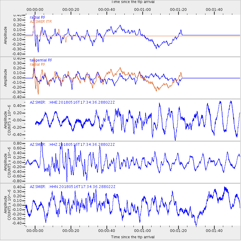
SMER AZ.SMER - Earthquake Result Viewer
*The percent match for this event was below the threshold and hence no stack was calculated.
| Earthquake location: |
South Of Kermadec Islands |
| Earthquake latitude/longitude: |
-33.9/-179.5 |
| Earthquake time(UTC): |
2018/05/16 (136) 17:22:13 GMT |
| Earthquake Depth: |
10 km |
| Earthquake Magnitude: |
5.8 Mww |
| Earthquake Catalog/Contributor: |
NEIC PDE/us |
|
| Network: |
AZ ANZA Regional Network |
| Station: |
SMER AZ.SMER |
| Lat/Lon: |
33.46 N/117.17 W |
| Elevation: |
355 m |
|
| Distance: |
89.0 deg |
| Az: |
47.797 deg |
| Baz: |
227.466 deg |
| Ray Param: |
$rayparam |
*The percent match for this event was below the threshold and hence was not used in the summary stack. |
|
| Radial Match: |
47.409237 % |
| Radial Bump: |
400 |
| Transverse Match: |
34.271435 % |
| Transverse Bump: |
400 |
| SOD ConfigId: |
13570011 |
| Insert Time: |
2019-04-30 06:23:51.536 +0000 |
| GWidth: |
2.5 |
| Max Bumps: |
400 |
| Tol: |
0.001 |
|
Signal To Noise
| Channel | StoN | STA | LTA |
| AZ:SMER: :HHZ:20180516T17:34:36.288022Z | 5.582663 | 3.4192902E-7 | 6.124837E-8 |
| AZ:SMER: :HHN:20180516T17:34:36.288022Z | 0.27392435 | 7.9116276E-8 | 2.8882528E-7 |
| AZ:SMER: :HHE:20180516T17:34:36.288022Z | 1.0394615 | 1.2204744E-7 | 1.1741411E-7 |
| Arrivals |
| Ps | |
| PpPs | |
| PsPs/PpSs | |


