You are here: Home > Network List > TA - USArray Transportable Network (new EarthScope stations) Stations List
> Station J20A Shoshoni, WY, USA > Earthquake Result Viewer
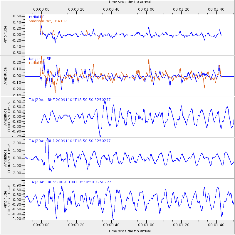
J20A Shoshoni, WY, USA - Earthquake Result Viewer
*The percent match for this event was below the threshold and hence no stack was calculated.
| Earthquake location: |
Azores Islands Region |
| Earthquake latitude/longitude: |
36.2/-33.9 |
| Earthquake time(UTC): |
2009/11/04 (308) 18:41:44 GMT |
| Earthquake Depth: |
10 km |
| Earthquake Magnitude: |
5.7 MB, 5.6 MS, 5.9 MW, 5.8 MW |
| Earthquake Catalog/Contributor: |
WHDF/NEIC |
|
| Network: |
TA USArray Transportable Network (new EarthScope stations) |
| Station: |
J20A Shoshoni, WY, USA |
| Lat/Lon: |
43.35 N/108.08 W |
| Elevation: |
1500 m |
|
| Distance: |
55.8 deg |
| Az: |
301.908 deg |
| Baz: |
70.368 deg |
| Ray Param: |
$rayparam |
*The percent match for this event was below the threshold and hence was not used in the summary stack. |
|
| Radial Match: |
71.334816 % |
| Radial Bump: |
393 |
| Transverse Match: |
78.67997 % |
| Transverse Bump: |
400 |
| SOD ConfigId: |
2622 |
| Insert Time: |
2010-03-06 11:12:59.516 +0000 |
| GWidth: |
2.5 |
| Max Bumps: |
400 |
| Tol: |
0.001 |
|
Signal To Noise
| Channel | StoN | STA | LTA |
| TA:J20A: :BHZ:20091104T18:50:50.325027Z | 11.799593 | 1.3828334E-6 | 1.17193316E-7 |
| TA:J20A: :BHN:20091104T18:50:50.325027Z | 2.0329516 | 3.7216992E-7 | 1.8306876E-7 |
| TA:J20A: :BHE:20091104T18:50:50.325027Z | 3.1892896 | 5.794264E-7 | 1.8167884E-7 |
| Arrivals |
| Ps | |
| PpPs | |
| PsPs/PpSs | |


