You are here: Home > Network List > GS - US Geological Survey Networks Stations List
> Station KAN13 Rinehart Farm > Earthquake Result Viewer
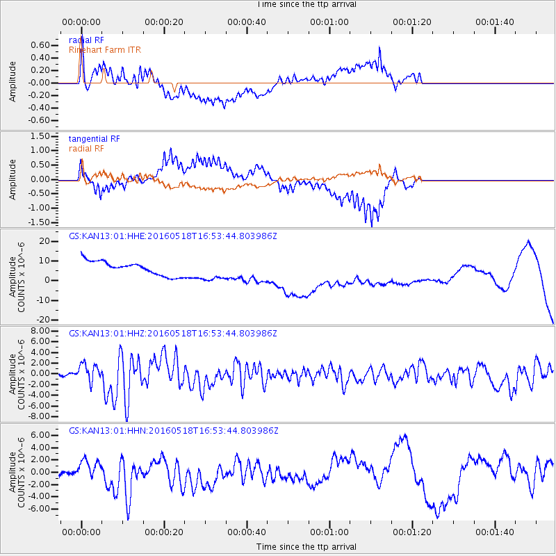
KAN13 Rinehart Farm - Earthquake Result Viewer
*The percent match for this event was below the threshold and hence no stack was calculated.
| Earthquake location: |
Near Coast Of Ecuador |
| Earthquake latitude/longitude: |
0.5/-79.6 |
| Earthquake time(UTC): |
2016/05/18 (139) 16:46:44 GMT |
| Earthquake Depth: |
31 km |
| Earthquake Magnitude: |
6.8 MO |
| Earthquake Catalog/Contributor: |
NEIC PDE/NEIC ALERT |
|
| Network: |
GS US Geological Survey Networks |
| Station: |
KAN13 Rinehart Farm |
| Lat/Lon: |
37.01 N/97.48 W |
| Elevation: |
340 m |
|
| Distance: |
39.9 deg |
| Az: |
337.545 deg |
| Baz: |
151.5 deg |
| Ray Param: |
$rayparam |
*The percent match for this event was below the threshold and hence was not used in the summary stack. |
|
| Radial Match: |
44.373165 % |
| Radial Bump: |
400 |
| Transverse Match: |
42.868946 % |
| Transverse Bump: |
333 |
| SOD ConfigId: |
1475611 |
| Insert Time: |
2016-06-01 16:50:00.256 +0000 |
| GWidth: |
2.5 |
| Max Bumps: |
400 |
| Tol: |
0.001 |
|
Signal To Noise
| Channel | StoN | STA | LTA |
| GS:KAN13:01:HHZ:20160518T16:53:44.803986Z | 11.106304 | 1.6914427E-6 | 1.5229573E-7 |
| GS:KAN13:01:HHN:20160518T16:53:44.803986Z | 0.5846969 | 9.780231E-7 | 1.6727009E-6 |
| GS:KAN13:01:HHE:20160518T16:53:44.803986Z | 1.5618627 | 5.420671E-6 | 3.470645E-6 |
| Arrivals |
| Ps | |
| PpPs | |
| PsPs/PpSs | |


