You are here: Home > Network List > TA - USArray Transportable Network (new EarthScope stations) Stations List
> Station J20A Shoshoni, WY, USA > Earthquake Result Viewer
J20A Shoshoni, WY, USA - Earthquake Result Viewer
*The percent match for this event was below the threshold and hence no stack was calculated.
| Earthquake location: |
Fiji Islands |
| Earthquake latitude/longitude: |
-16.2/178.3 |
| Earthquake time(UTC): |
2009/02/11 (042) 13:52:41 GMT |
| Earthquake Depth: |
10 km |
| Earthquake Magnitude: |
5.6 MB, 5.3 MS, 5.7 MW, 5.7 MW |
| Earthquake Catalog/Contributor: |
WHDF/NEIC |
|
| Network: |
TA USArray Transportable Network (new EarthScope stations) |
| Station: |
J20A Shoshoni, WY, USA |
| Lat/Lon: |
43.35 N/108.08 W |
| Elevation: |
1500 m |
|
| Distance: |
89.5 deg |
| Az: |
44.405 deg |
| Baz: |
247.157 deg |
| Ray Param: |
$rayparam |
*The percent match for this event was below the threshold and hence was not used in the summary stack. |
|
| Radial Match: |
71.59908 % |
| Radial Bump: |
400 |
| Transverse Match: |
70.53397 % |
| Transverse Bump: |
400 |
| SOD ConfigId: |
2658 |
| Insert Time: |
2010-03-06 11:13:36.120 +0000 |
| GWidth: |
2.5 |
| Max Bumps: |
400 |
| Tol: |
0.001 |
|
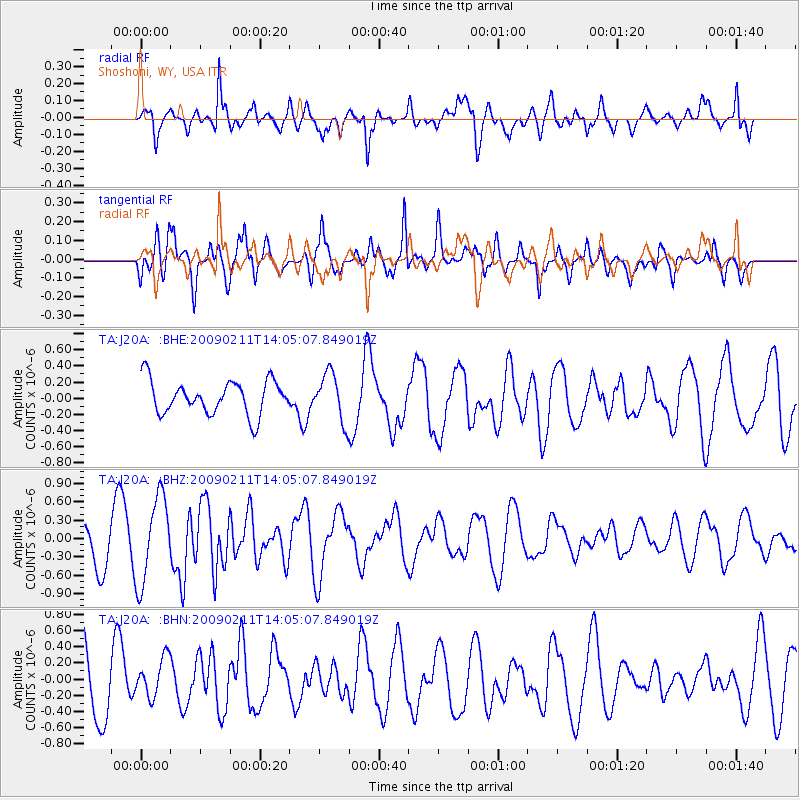
Signal To Noise
| Channel | StoN | STA | LTA |
| TA:J20A: :BHZ:20090211T14:05:07.849019Z | 1.8426776 | 7.0089425E-7 | 3.8036728E-7 |
| TA:J20A: :BHN:20090211T14:05:07.849019Z | 0.7241534 | 2.5120454E-7 | 3.468941E-7 |
| TA:J20A: :BHE:20090211T14:05:07.849019Z | 1.4228706 | 2.9499301E-7 | 2.0732244E-7 |
| Arrivals |
| Ps | |
| PpPs | |
| PsPs/PpSs | |


